
ANA XW.ANA - Earthquake Result Viewer
| ||||||||||||||||||
| ||||||||||||||||||
| ||||||||||||||||||
|
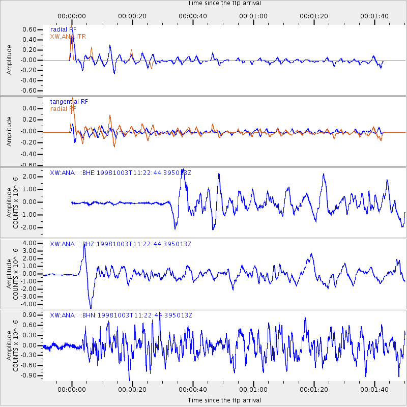
Signal To Noise
| Channel | StoN | STA | LTA |
| XW:ANA: :BHZ:19981003T11:22:44.395013Z | 18.912281 | 1.4295892E-6 | 7.559053E-8 |
| XW:ANA: :BHN:19981003T11:22:44.395013Z | 2.230747 | 1.404666E-7 | 6.296841E-8 |
| XW:ANA: :BHE:19981003T11:22:44.395013Z | 15.260775 | 8.1147596E-7 | 5.317397E-8 |
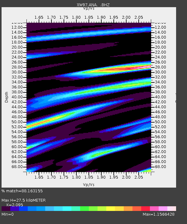
| Arrivals | |
| Ps | 5.0 SECOND |
| PpPs | 13 SECOND |
| PsPs/PpSs | 18 SECOND |

