You are here: Home > Network List > IU - Global Seismograph Network (GSN - IRIS/USGS) Stations List
> Station PMG Port Moresby, New Guinea > Earthquake Result Viewer
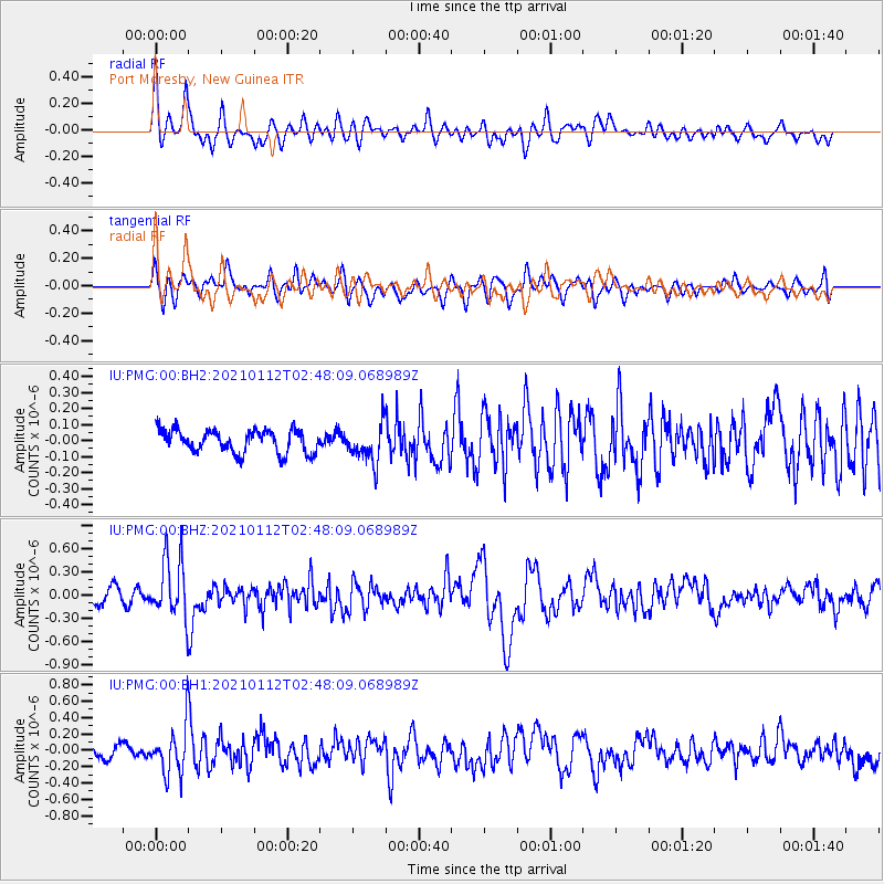
PMG Port Moresby, New Guinea - Earthquake Result Viewer
*The percent match for this event was below the threshold and hence no stack was calculated.
| Earthquake location: |
Eastern Sea Of Japan |
| Earthquake latitude/longitude: |
43.7/140.0 |
| Earthquake time(UTC): |
2021/01/12 (012) 02:39:42 GMT |
| Earthquake Depth: |
211 km |
| Earthquake Magnitude: |
5.9 mww |
| Earthquake Catalog/Contributor: |
NEIC PDE/us |
|
| Network: |
IU Global Seismograph Network (GSN - IRIS/USGS) |
| Station: |
PMG Port Moresby, New Guinea |
| Lat/Lon: |
9.40 S/147.16 E |
| Elevation: |
90 m |
|
| Distance: |
53.3 deg |
| Az: |
171.166 deg |
| Baz: |
353.519 deg |
| Ray Param: |
$rayparam |
*The percent match for this event was below the threshold and hence was not used in the summary stack. |
|
| Radial Match: |
75.27768 % |
| Radial Bump: |
400 |
| Transverse Match: |
63.051586 % |
| Transverse Bump: |
400 |
| SOD ConfigId: |
23341671 |
| Insert Time: |
2021-01-26 03:53:59.866 +0000 |
| GWidth: |
2.5 |
| Max Bumps: |
400 |
| Tol: |
0.001 |
|
Signal To Noise
| Channel | StoN | STA | LTA |
| IU:PMG:00:BHZ:20210112T02:48:09.068989Z | 3.9366734 | 3.8932842E-7 | 9.889782E-8 |
| IU:PMG:00:BH1:20210112T02:48:09.068989Z | 3.079643 | 2.965429E-7 | 9.629132E-8 |
| IU:PMG:00:BH2:20210112T02:48:09.068989Z | 1.6541482 | 1.1733944E-7 | 7.093647E-8 |
| Arrivals |
| Ps | |
| PpPs | |
| PsPs/PpSs | |


