You are here: Home > Network List > TA - USArray Transportable Network (new EarthScope stations) Stations List
> Station D23K Nanushuk River, AK USA > Earthquake Result Viewer
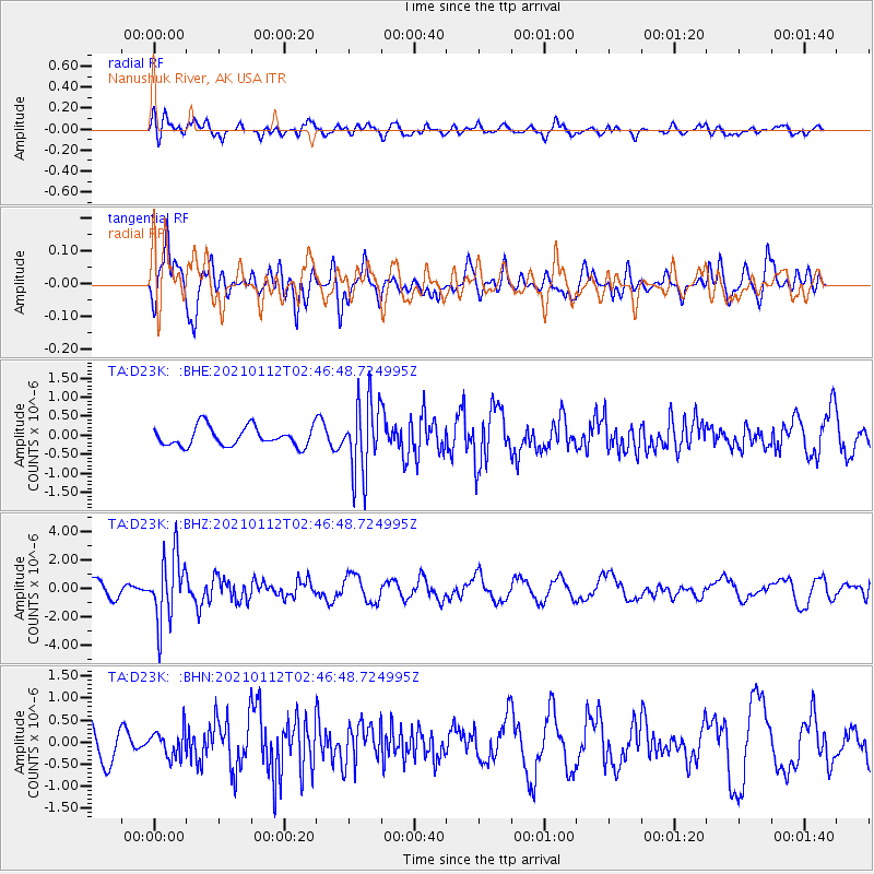
D23K Nanushuk River, AK USA - Earthquake Result Viewer
*The percent match for this event was below the threshold and hence no stack was calculated.
| Earthquake location: |
Eastern Sea Of Japan |
| Earthquake latitude/longitude: |
43.7/140.0 |
| Earthquake time(UTC): |
2021/01/12 (012) 02:39:42 GMT |
| Earthquake Depth: |
211 km |
| Earthquake Magnitude: |
5.9 mww |
| Earthquake Catalog/Contributor: |
NEIC PDE/us |
|
| Network: |
TA USArray Transportable Network (new EarthScope stations) |
| Station: |
D23K Nanushuk River, AK USA |
| Lat/Lon: |
68.97 N/150.68 W |
| Elevation: |
406 m |
|
| Distance: |
42.7 deg |
| Az: |
29.852 deg |
| Baz: |
270.825 deg |
| Ray Param: |
$rayparam |
*The percent match for this event was below the threshold and hence was not used in the summary stack. |
|
| Radial Match: |
48.853333 % |
| Radial Bump: |
400 |
| Transverse Match: |
65.47147 % |
| Transverse Bump: |
349 |
| SOD ConfigId: |
23341671 |
| Insert Time: |
2021-01-26 04:03:42.269 +0000 |
| GWidth: |
2.5 |
| Max Bumps: |
400 |
| Tol: |
0.001 |
|
Signal To Noise
| Channel | StoN | STA | LTA |
| TA:D23K: :BHZ:20210112T02:46:48.724995Z | 3.9264789 | 2.336466E-6 | 5.9505373E-7 |
| TA:D23K: :BHN:20210112T02:46:48.724995Z | 0.7776896 | 3.024096E-7 | 3.8885642E-7 |
| TA:D23K: :BHE:20210112T02:46:48.724995Z | 3.8039796 | 9.622158E-7 | 2.5294977E-7 |
| Arrivals |
| Ps | |
| PpPs | |
| PsPs/PpSs | |


