You are here: Home > Network List > US - United States National Seismic Network Stations List
> Station EGMT Eagleton, Montana, USA > Earthquake Result Viewer
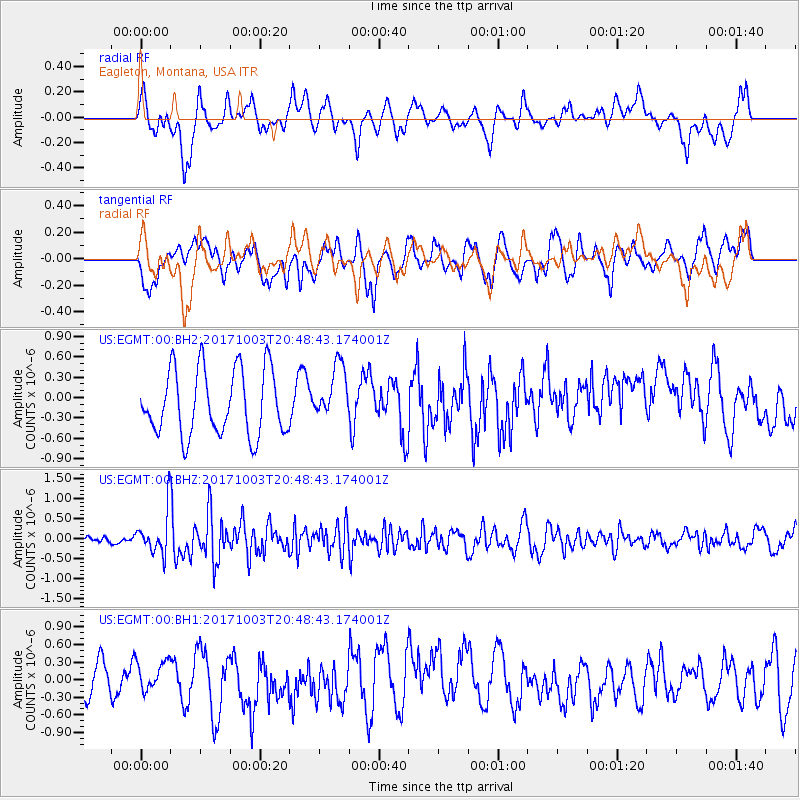
EGMT Eagleton, Montana, USA - Earthquake Result Viewer
*The percent match for this event was below the threshold and hence no stack was calculated.
| Earthquake location: |
North Atlantic Ocean |
| Earthquake latitude/longitude: |
13.5/-49.3 |
| Earthquake time(UTC): |
2017/10/03 (276) 20:39:04 GMT |
| Earthquake Depth: |
10 km |
| Earthquake Magnitude: |
5.7 Mww |
| Earthquake Catalog/Contributor: |
NEIC PDE/us |
|
| Network: |
US United States National Seismic Network |
| Station: |
EGMT Eagleton, Montana, USA |
| Lat/Lon: |
48.02 N/109.75 W |
| Elevation: |
1055 m |
|
| Distance: |
60.4 deg |
| Az: |
317.825 deg |
| Baz: |
103.335 deg |
| Ray Param: |
$rayparam |
*The percent match for this event was below the threshold and hence was not used in the summary stack. |
|
| Radial Match: |
39.72226 % |
| Radial Bump: |
400 |
| Transverse Match: |
42.711845 % |
| Transverse Bump: |
400 |
| SOD ConfigId: |
2364251 |
| Insert Time: |
2017-10-17 20:43:10.652 +0000 |
| GWidth: |
2.5 |
| Max Bumps: |
400 |
| Tol: |
0.001 |
|
Signal To Noise
| Channel | StoN | STA | LTA |
| US:EGMT:00:BHZ:20171003T20:48:43.174001Z | 4.406159 | 5.311745E-7 | 1.2055274E-7 |
| US:EGMT:00:BH1:20171003T20:48:43.174001Z | 0.8540358 | 2.5659077E-7 | 3.0044498E-7 |
| US:EGMT:00:BH2:20171003T20:48:43.174001Z | 0.8516279 | 4.0766992E-7 | 4.7869486E-7 |
| Arrivals |
| Ps | |
| PpPs | |
| PsPs/PpSs | |


