You are here: Home > Network List > US - United States National Seismic Network Stations List
> Station EGMT Eagleton, Montana, USA > Earthquake Result Viewer
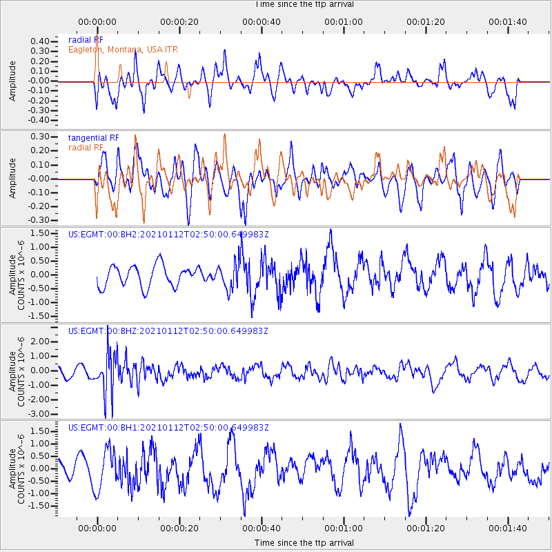
EGMT Eagleton, Montana, USA - Earthquake Result Viewer
*The percent match for this event was below the threshold and hence no stack was calculated.
| Earthquake location: |
Eastern Sea Of Japan |
| Earthquake latitude/longitude: |
43.7/140.0 |
| Earthquake time(UTC): |
2021/01/12 (012) 02:39:42 GMT |
| Earthquake Depth: |
211 km |
| Earthquake Magnitude: |
5.9 mww |
| Earthquake Catalog/Contributor: |
NEIC PDE/us |
|
| Network: |
US United States National Seismic Network |
| Station: |
EGMT Eagleton, Montana, USA |
| Lat/Lon: |
48.02 N/109.75 W |
| Elevation: |
1055 m |
|
| Distance: |
70.0 deg |
| Az: |
42.08 deg |
| Baz: |
313.612 deg |
| Ray Param: |
$rayparam |
*The percent match for this event was below the threshold and hence was not used in the summary stack. |
|
| Radial Match: |
43.242027 % |
| Radial Bump: |
400 |
| Transverse Match: |
46.143093 % |
| Transverse Bump: |
400 |
| SOD ConfigId: |
23341671 |
| Insert Time: |
2021-01-26 04:07:28.481 +0000 |
| GWidth: |
2.5 |
| Max Bumps: |
400 |
| Tol: |
0.001 |
|
Signal To Noise
| Channel | StoN | STA | LTA |
| US:EGMT:00:BHZ:20210112T02:50:00.649983Z | 5.585766 | 1.3882565E-6 | 2.485347E-7 |
| US:EGMT:00:BH1:20210112T02:50:00.649983Z | 1.9876292 | 8.3358196E-7 | 4.1938503E-7 |
| US:EGMT:00:BH2:20210112T02:50:00.649983Z | 1.2524397 | 4.7973083E-7 | 3.8303705E-7 |
| Arrivals |
| Ps | |
| PpPs | |
| PsPs/PpSs | |


