You are here: Home > Network List > US - United States National Seismic Network Stations List
> Station MIAR Mount Ida, Arkansas, USA > Earthquake Result Viewer
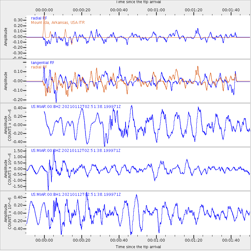
MIAR Mount Ida, Arkansas, USA - Earthquake Result Viewer
*The percent match for this event was below the threshold and hence no stack was calculated.
| Earthquake location: |
Eastern Sea Of Japan |
| Earthquake latitude/longitude: |
43.7/140.0 |
| Earthquake time(UTC): |
2021/01/12 (012) 02:39:42 GMT |
| Earthquake Depth: |
211 km |
| Earthquake Magnitude: |
5.9 mww |
| Earthquake Catalog/Contributor: |
NEIC PDE/us |
|
| Network: |
US United States National Seismic Network |
| Station: |
MIAR Mount Ida, Arkansas, USA |
| Lat/Lon: |
34.55 N/93.58 W |
| Elevation: |
207 m |
|
| Distance: |
88.1 deg |
| Az: |
41.646 deg |
| Baz: |
324.278 deg |
| Ray Param: |
$rayparam |
*The percent match for this event was below the threshold and hence was not used in the summary stack. |
|
| Radial Match: |
53.367893 % |
| Radial Bump: |
400 |
| Transverse Match: |
59.875183 % |
| Transverse Bump: |
400 |
| SOD ConfigId: |
23341671 |
| Insert Time: |
2021-01-26 04:07:49.707 +0000 |
| GWidth: |
2.5 |
| Max Bumps: |
400 |
| Tol: |
0.001 |
|
Signal To Noise
| Channel | StoN | STA | LTA |
| US:MIAR:00:BHZ:20210112T02:51:38.199971Z | 4.1696405 | 6.30775E-7 | 1.5127802E-7 |
| US:MIAR:00:BH1:20210112T02:51:38.199971Z | 1.164767 | 2.1268113E-7 | 1.8259544E-7 |
| US:MIAR:00:BH2:20210112T02:51:38.199971Z | 1.2101027 | 2.4068254E-7 | 1.988943E-7 |
| Arrivals |
| Ps | |
| PpPs | |
| PsPs/PpSs | |


