You are here: Home > Network List > US - United States National Seismic Network Stations List
> Station LKWY Lake (Yellowstone--Lake), Wyoming, USA > Earthquake Result Viewer
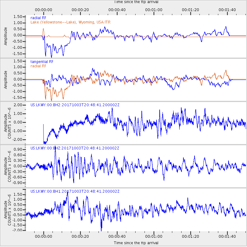
LKWY Lake (Yellowstone--Lake), Wyoming, USA - Earthquake Result Viewer
*The percent match for this event was below the threshold and hence no stack was calculated.
| Earthquake location: |
North Atlantic Ocean |
| Earthquake latitude/longitude: |
13.5/-49.3 |
| Earthquake time(UTC): |
2017/10/03 (276) 20:39:04 GMT |
| Earthquake Depth: |
10 km |
| Earthquake Magnitude: |
5.7 Mww |
| Earthquake Catalog/Contributor: |
NEIC PDE/us |
|
| Network: |
US United States National Seismic Network |
| Station: |
LKWY Lake (Yellowstone--Lake), Wyoming, USA |
| Lat/Lon: |
44.57 N/110.40 W |
| Elevation: |
2424 m |
|
| Distance: |
60.1 deg |
| Az: |
313.822 deg |
| Baz: |
100.884 deg |
| Ray Param: |
$rayparam |
*The percent match for this event was below the threshold and hence was not used in the summary stack. |
|
| Radial Match: |
29.186113 % |
| Radial Bump: |
400 |
| Transverse Match: |
24.786793 % |
| Transverse Bump: |
400 |
| SOD ConfigId: |
2364251 |
| Insert Time: |
2017-10-17 20:43:25.472 +0000 |
| GWidth: |
2.5 |
| Max Bumps: |
400 |
| Tol: |
0.001 |
|
Signal To Noise
| Channel | StoN | STA | LTA |
| US:LKWY:00:BHZ:20171003T20:48:41.200002Z | 0.8721084 | 1.00633166E-7 | 1.1539066E-7 |
| US:LKWY:00:BH1:20171003T20:48:41.200002Z | 0.68451774 | 3.345038E-7 | 4.8867076E-7 |
| US:LKWY:00:BH2:20171003T20:48:41.200002Z | 1.3763134 | 1.0779139E-6 | 7.8318925E-7 |
| Arrivals |
| Ps | |
| PpPs | |
| PsPs/PpSs | |


