You are here: Home > Network List > US - United States National Seismic Network Stations List
> Station MNTX Cornudas Mountains, Texas, USA > Earthquake Result Viewer
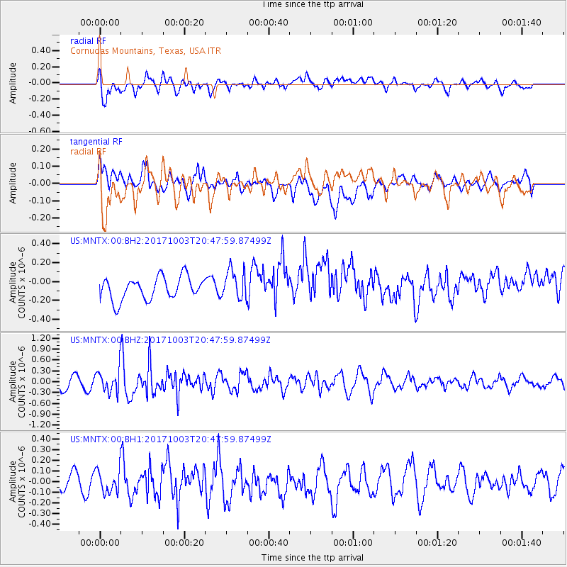
MNTX Cornudas Mountains, Texas, USA - Earthquake Result Viewer
*The percent match for this event was below the threshold and hence no stack was calculated.
| Earthquake location: |
North Atlantic Ocean |
| Earthquake latitude/longitude: |
13.5/-49.3 |
| Earthquake time(UTC): |
2017/10/03 (276) 20:39:04 GMT |
| Earthquake Depth: |
10 km |
| Earthquake Magnitude: |
5.7 Mww |
| Earthquake Catalog/Contributor: |
NEIC PDE/us |
|
| Network: |
US United States National Seismic Network |
| Station: |
MNTX Cornudas Mountains, Texas, USA |
| Lat/Lon: |
31.70 N/105.38 W |
| Elevation: |
404 m |
|
| Distance: |
54.3 deg |
| Az: |
299.413 deg |
| Baz: |
96.147 deg |
| Ray Param: |
$rayparam |
*The percent match for this event was below the threshold and hence was not used in the summary stack. |
|
| Radial Match: |
64.0845 % |
| Radial Bump: |
400 |
| Transverse Match: |
58.76461 % |
| Transverse Bump: |
400 |
| SOD ConfigId: |
2364251 |
| Insert Time: |
2017-10-17 20:43:32.635 +0000 |
| GWidth: |
2.5 |
| Max Bumps: |
400 |
| Tol: |
0.001 |
|
Signal To Noise
| Channel | StoN | STA | LTA |
| US:MNTX:00:BHZ:20171003T20:47:59.87499Z | 1.9844073 | 3.2055854E-7 | 1.6153868E-7 |
| US:MNTX:00:BH1:20171003T20:47:59.87499Z | 0.9665451 | 1.1037551E-7 | 1.1419593E-7 |
| US:MNTX:00:BH2:20171003T20:47:59.87499Z | 1.3104345 | 1.5712071E-7 | 1.1989971E-7 |
| Arrivals |
| Ps | |
| PpPs | |
| PsPs/PpSs | |


