You are here: Home > Network List > US - United States National Seismic Network Stations List
> Station RLMT Red Lodge, Montana, USA > Earthquake Result Viewer
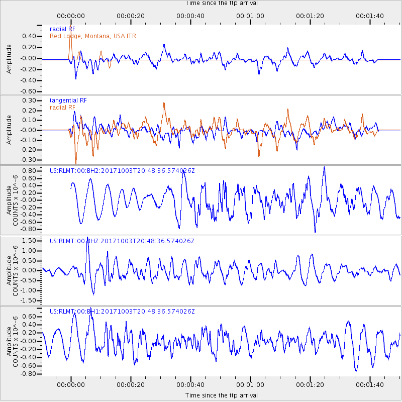
RLMT Red Lodge, Montana, USA - Earthquake Result Viewer
*The percent match for this event was below the threshold and hence no stack was calculated.
| Earthquake location: |
North Atlantic Ocean |
| Earthquake latitude/longitude: |
13.5/-49.3 |
| Earthquake time(UTC): |
2017/10/03 (276) 20:39:04 GMT |
| Earthquake Depth: |
10 km |
| Earthquake Magnitude: |
5.7 Mww |
| Earthquake Catalog/Contributor: |
NEIC PDE/us |
|
| Network: |
US United States National Seismic Network |
| Station: |
RLMT Red Lodge, Montana, USA |
| Lat/Lon: |
45.12 N/109.27 W |
| Elevation: |
2086 m |
|
| Distance: |
59.5 deg |
| Az: |
314.639 deg |
| Baz: |
102.091 deg |
| Ray Param: |
$rayparam |
*The percent match for this event was below the threshold and hence was not used in the summary stack. |
|
| Radial Match: |
48.039444 % |
| Radial Bump: |
400 |
| Transverse Match: |
36.99504 % |
| Transverse Bump: |
400 |
| SOD ConfigId: |
2364251 |
| Insert Time: |
2017-10-17 20:43:44.489 +0000 |
| GWidth: |
2.5 |
| Max Bumps: |
400 |
| Tol: |
0.001 |
|
Signal To Noise
| Channel | StoN | STA | LTA |
| US:RLMT:00:BHZ:20171003T20:48:36.574026Z | 1.0928634 | 2.3532412E-7 | 2.1532801E-7 |
| US:RLMT:00:BH1:20171003T20:48:36.574026Z | 2.6215644 | 4.198619E-7 | 1.60157E-7 |
| US:RLMT:00:BH2:20171003T20:48:36.574026Z | 0.6976961 | 2.2710648E-7 | 3.255092E-7 |
| Arrivals |
| Ps | |
| PpPs | |
| PsPs/PpSs | |


