You are here: Home > Network List > CI - Caltech Regional Seismic Network Stations List
> Station LRL Laurel Mtn Radio Fac, Ridgecrest, CA, USA > Earthquake Result Viewer
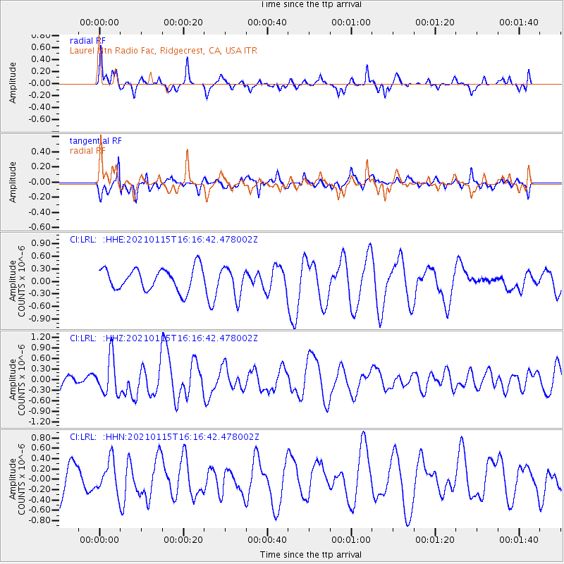
LRL Laurel Mtn Radio Fac, Ridgecrest, CA, USA - Earthquake Result Viewer
*The percent match for this event was below the threshold and hence no stack was calculated.
| Earthquake location: |
Off Coast Of Chiapas, Mexico |
| Earthquake latitude/longitude: |
13.9/-92.1 |
| Earthquake time(UTC): |
2021/01/15 (015) 16:10:51 GMT |
| Earthquake Depth: |
10 km |
| Earthquake Magnitude: |
5.9 mww |
| Earthquake Catalog/Contributor: |
NEIC PDE/us |
|
| Network: |
CI Caltech Regional Seismic Network |
| Station: |
LRL Laurel Mtn Radio Fac, Ridgecrest, CA, USA |
| Lat/Lon: |
35.48 N/117.68 W |
| Elevation: |
1340 m |
|
| Distance: |
31.5 deg |
| Az: |
317.549 deg |
| Baz: |
126.576 deg |
| Ray Param: |
$rayparam |
*The percent match for this event was below the threshold and hence was not used in the summary stack. |
|
| Radial Match: |
52.63567 % |
| Radial Bump: |
298 |
| Transverse Match: |
47.268475 % |
| Transverse Bump: |
400 |
| SOD ConfigId: |
23341671 |
| Insert Time: |
2021-01-29 17:17:47.535 +0000 |
| GWidth: |
2.5 |
| Max Bumps: |
400 |
| Tol: |
0.001 |
|
Signal To Noise
| Channel | StoN | STA | LTA |
| CI:LRL: :HHZ:20210115T16:16:42.478002Z | 2.5753396 | 5.373553E-7 | 2.0865414E-7 |
| CI:LRL: :HHN:20210115T16:16:42.478002Z | 0.86326915 | 3.0706062E-7 | 3.556951E-7 |
| CI:LRL: :HHE:20210115T16:16:42.478002Z | 1.3348885 | 3.5228564E-7 | 2.6390643E-7 |
| Arrivals |
| Ps | |
| PpPs | |
| PsPs/PpSs | |


