You are here: Home > Network List > CI - Caltech Regional Seismic Network Stations List
> Station MPM Manuel Prospect Mine, California, USA > Earthquake Result Viewer
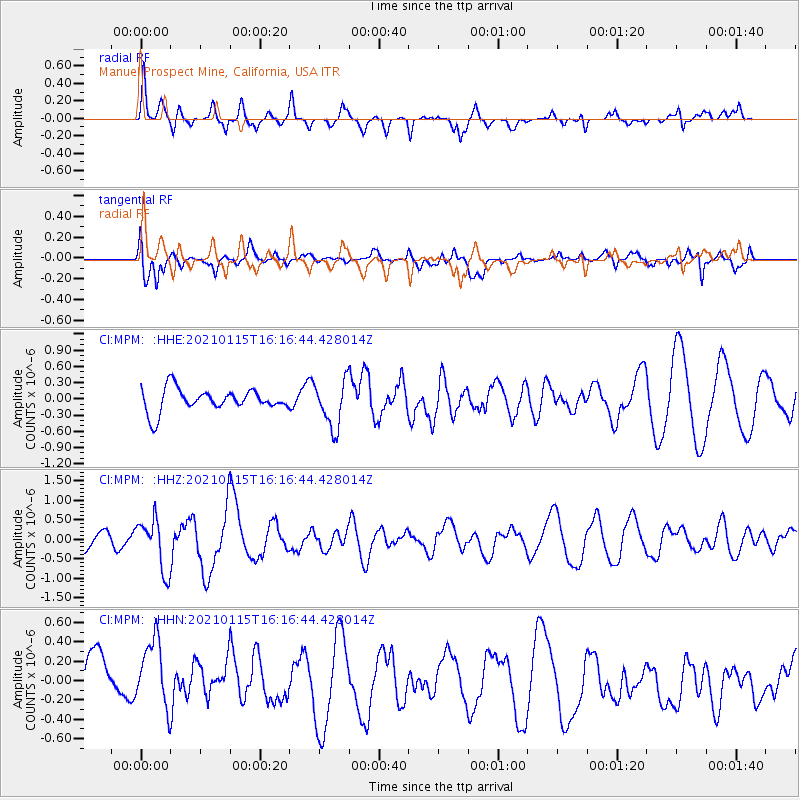
MPM Manuel Prospect Mine, California, USA - Earthquake Result Viewer
*The percent match for this event was below the threshold and hence no stack was calculated.
| Earthquake location: |
Off Coast Of Chiapas, Mexico |
| Earthquake latitude/longitude: |
13.9/-92.1 |
| Earthquake time(UTC): |
2021/01/15 (015) 16:10:51 GMT |
| Earthquake Depth: |
10 km |
| Earthquake Magnitude: |
5.9 mww |
| Earthquake Catalog/Contributor: |
NEIC PDE/us |
|
| Network: |
CI Caltech Regional Seismic Network |
| Station: |
MPM Manuel Prospect Mine, California, USA |
| Lat/Lon: |
36.06 N/117.49 W |
| Elevation: |
185 m |
|
| Distance: |
31.7 deg |
| Az: |
318.609 deg |
| Baz: |
127.591 deg |
| Ray Param: |
$rayparam |
*The percent match for this event was below the threshold and hence was not used in the summary stack. |
|
| Radial Match: |
67.33644 % |
| Radial Bump: |
400 |
| Transverse Match: |
59.561436 % |
| Transverse Bump: |
400 |
| SOD ConfigId: |
23341671 |
| Insert Time: |
2021-01-29 17:17:51.171 +0000 |
| GWidth: |
2.5 |
| Max Bumps: |
400 |
| Tol: |
0.001 |
|
Signal To Noise
| Channel | StoN | STA | LTA |
| CI:MPM: :HHZ:20210115T16:16:44.428014Z | 3.1522498 | 6.5922904E-7 | 2.091297E-7 |
| CI:MPM: :HHN:20210115T16:16:44.428014Z | 1.1437225 | 3.8506744E-7 | 3.3667908E-7 |
| CI:MPM: :HHE:20210115T16:16:44.428014Z | 2.0677285 | 4.3144462E-7 | 2.0865632E-7 |
| Arrivals |
| Ps | |
| PpPs | |
| PsPs/PpSs | |


