You are here: Home > Network List > TA - USArray Transportable Network (new EarthScope stations) Stations List
> Station H31M Peel River, Yukon, CAN > Earthquake Result Viewer
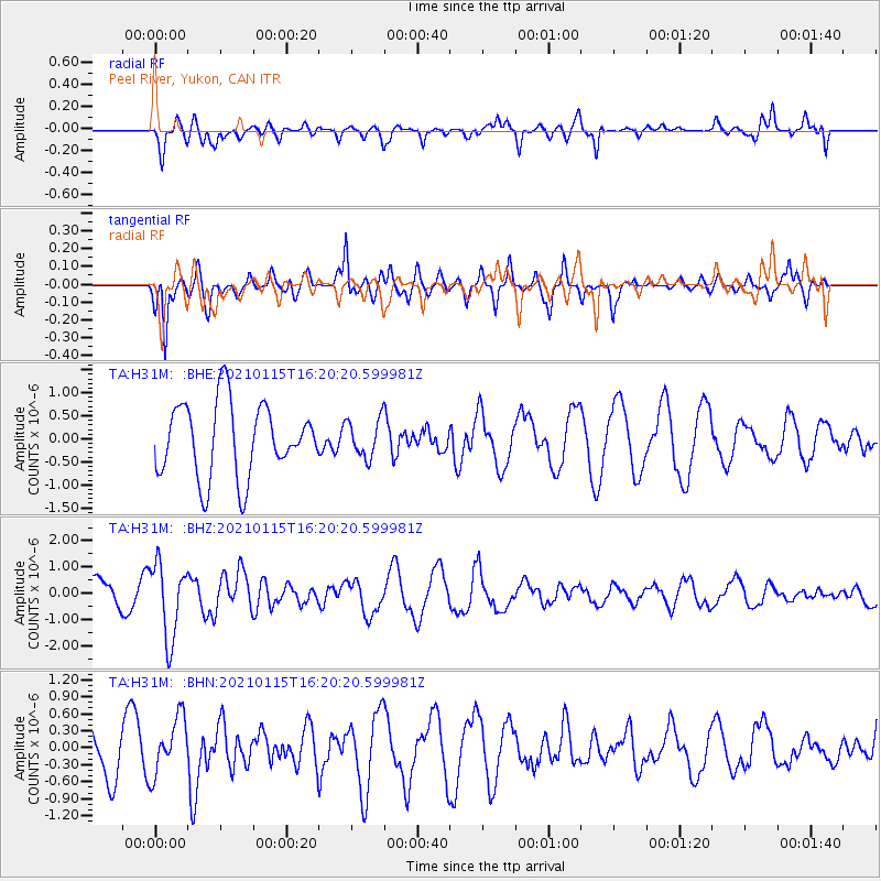
H31M Peel River, Yukon, CAN - Earthquake Result Viewer
*The percent match for this event was below the threshold and hence no stack was calculated.
| Earthquake location: |
Off Coast Of Chiapas, Mexico |
| Earthquake latitude/longitude: |
13.9/-92.1 |
| Earthquake time(UTC): |
2021/01/15 (015) 16:10:51 GMT |
| Earthquake Depth: |
10 km |
| Earthquake Magnitude: |
5.9 mww |
| Earthquake Catalog/Contributor: |
NEIC PDE/us |
|
| Network: |
TA USArray Transportable Network (new EarthScope stations) |
| Station: |
H31M Peel River, Yukon, CAN |
| Lat/Lon: |
65.81 N/134.34 W |
| Elevation: |
642 m |
|
| Distance: |
59.1 deg |
| Az: |
341.156 deg |
| Baz: |
130.444 deg |
| Ray Param: |
$rayparam |
*The percent match for this event was below the threshold and hence was not used in the summary stack. |
|
| Radial Match: |
46.92143 % |
| Radial Bump: |
400 |
| Transverse Match: |
79.27936 % |
| Transverse Bump: |
345 |
| SOD ConfigId: |
23341671 |
| Insert Time: |
2021-01-29 17:25:00.923 +0000 |
| GWidth: |
2.5 |
| Max Bumps: |
400 |
| Tol: |
0.001 |
|
Signal To Noise
| Channel | StoN | STA | LTA |
| TA:H31M: :BHZ:20210115T16:20:20.599981Z | 2.7928274 | 1.4257836E-6 | 5.1051614E-7 |
| TA:H31M: :BHN:20210115T16:20:20.599981Z | 0.9212271 | 5.035916E-7 | 5.4665304E-7 |
| TA:H31M: :BHE:20210115T16:20:20.599981Z | 0.5230097 | 4.1583073E-7 | 7.9507265E-7 |
| Arrivals |
| Ps | |
| PpPs | |
| PsPs/PpSs | |


