You are here: Home > Network List > TA - USArray Transportable Network (new EarthScope stations) Stations List
> Station A36M Sachs Harbour, NT, CAN > Earthquake Result Viewer
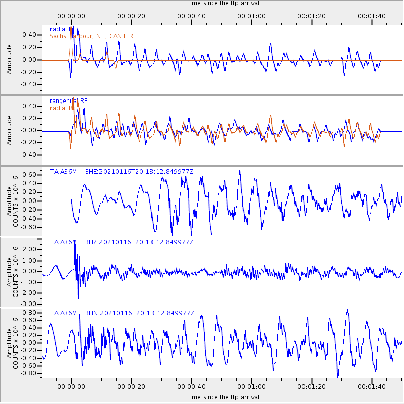
A36M Sachs Harbour, NT, CAN - Earthquake Result Viewer
*The percent match for this event was below the threshold and hence no stack was calculated.
| Earthquake location: |
Hindu Kush Region, Afghanistan |
| Earthquake latitude/longitude: |
36.5/70.7 |
| Earthquake time(UTC): |
2021/01/16 (016) 20:02:45 GMT |
| Earthquake Depth: |
192 km |
| Earthquake Magnitude: |
5.5 Mww |
| Earthquake Catalog/Contributor: |
NEIC PDE/us |
|
| Network: |
TA USArray Transportable Network (new EarthScope stations) |
| Station: |
A36M Sachs Harbour, NT, CAN |
| Lat/Lon: |
71.99 N/125.25 W |
| Elevation: |
32 m |
|
| Distance: |
71.2 deg |
| Az: |
5.193 deg |
| Baz: |
346.448 deg |
| Ray Param: |
$rayparam |
*The percent match for this event was below the threshold and hence was not used in the summary stack. |
|
| Radial Match: |
63.680706 % |
| Radial Bump: |
400 |
| Transverse Match: |
76.18877 % |
| Transverse Bump: |
400 |
| SOD ConfigId: |
23341671 |
| Insert Time: |
2021-01-30 21:12:58.737 +0000 |
| GWidth: |
2.5 |
| Max Bumps: |
400 |
| Tol: |
0.001 |
|
Signal To Noise
| Channel | StoN | STA | LTA |
| TA:A36M: :BHZ:20210116T20:13:12.849977Z | 3.0558755 | 1.013966E-6 | 3.3180868E-7 |
| TA:A36M: :BHN:20210116T20:13:12.849977Z | 1.0033275 | 3.1787036E-7 | 3.1681614E-7 |
| TA:A36M: :BHE:20210116T20:13:12.849977Z | 1.9451567 | 4.1725852E-7 | 2.1451153E-7 |
| Arrivals |
| Ps | |
| PpPs | |
| PsPs/PpSs | |


