You are here: Home > Network List > GS - US Geological Survey Networks Stations List
> Station DEC06 Boomer > Earthquake Result Viewer
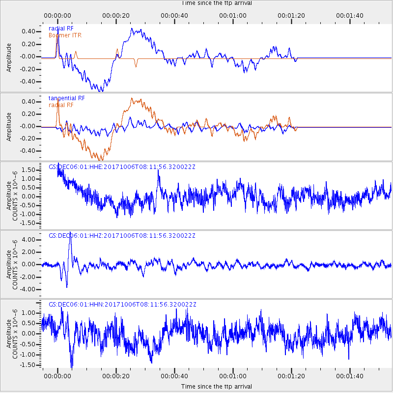
DEC06 Boomer - Earthquake Result Viewer
*The percent match for this event was below the threshold and hence no stack was calculated.
| Earthquake location: |
Off East Coast Of Honshu, Japan |
| Earthquake latitude/longitude: |
37.5/144.0 |
| Earthquake time(UTC): |
2017/10/06 (279) 07:59:33 GMT |
| Earthquake Depth: |
10 km |
| Earthquake Magnitude: |
6.0 Mww |
| Earthquake Catalog/Contributor: |
NEIC PDE/us |
|
| Network: |
GS US Geological Survey Networks |
| Station: |
DEC06 Boomer |
| Lat/Lon: |
39.90 N/88.95 W |
| Elevation: |
215 m |
|
| Distance: |
89.0 deg |
| Az: |
37.857 deg |
| Baz: |
320.612 deg |
| Ray Param: |
$rayparam |
*The percent match for this event was below the threshold and hence was not used in the summary stack. |
|
| Radial Match: |
40.967705 % |
| Radial Bump: |
400 |
| Transverse Match: |
51.836952 % |
| Transverse Bump: |
400 |
| SOD ConfigId: |
2364251 |
| Insert Time: |
2017-10-20 08:02:14.982 +0000 |
| GWidth: |
2.5 |
| Max Bumps: |
400 |
| Tol: |
0.001 |
|
Signal To Noise
| Channel | StoN | STA | LTA |
| GS:DEC06:01:HHZ:20171006T08:11:56.320022Z | 9.517846 | 2.1296496E-6 | 2.237533E-7 |
| GS:DEC06:01:HHN:20171006T08:11:56.320022Z | 0.7202396 | 7.800035E-7 | 1.0829777E-6 |
| GS:DEC06:01:HHE:20171006T08:11:56.320022Z | 0.8943821 | 5.8531674E-7 | 6.54437E-7 |
| Arrivals |
| Ps | |
| PpPs | |
| PsPs/PpSs | |


