ANA XW.ANA - Earthquake Result Viewer
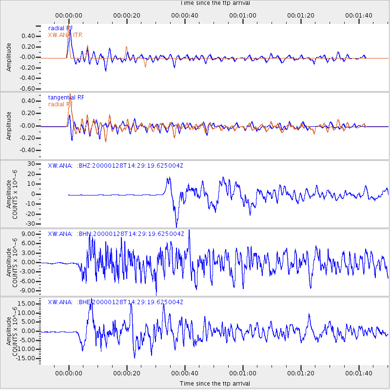
Earthquake location: Kuril Islands
Earthquake latitude/longitude: 43.0/146.8
Earthquake time(UTC): 2000/01/28 (028) 14:21:07 GMT
Earthquake Depth: 61 km
Earthquake Magnitude: 6.7 MB, 6.6 MS, 6.8 MW, 6.8 ME
Earthquake Catalog/Contributor: WHDF/NEIC
Network: XW Tien Shan Continental Dynamics
Station: ANA XW.ANA
Lat/Lon: 42.78 N/77.66 E
Elevation: 1813 m
Distance: 49.3 deg
Az: 294.815 deg
Baz: 64.669 deg
Ray Param: 0.0686207
Estimated Moho Depth: 33.25 km
Estimated Crust Vp/Vs: 1.83
Assumed Crust Vp: 6.306 km/s
Estimated Crust Vs: 3.455 km/s
Estimated Crust Poisson's Ratio: 0.29
Radial Match: 89.144485 %
Radial Bump: 400
Transverse Match: 79.73109 %
Transverse Bump: 400
SOD ConfigId: 20082
Insert Time: 2010-02-26 15:16:03.256 +0000
GWidth: 2.5
Max Bumps: 400
Tol: 0.001

Signal To Noise

ChannelStoNSTALTA
XW:ANA: :BHN:20000128T14:29:19.625004Z11.3180211.470731E-61.2994596E-7
XW:ANA: :BHE:20000128T14:29:19.625004Z43.8725623.3130573E-67.551547E-8
XW:ANA: :BHZ:20000128T14:29:19.625004Z42.515576.940078E-61.6323615E-7
Arrivals
Ps4.6 SECOND
PpPs14 SECOND
PsPs/PpSs19 SECOND