You are here: Home > Network List > GS - US Geological Survey Networks Stations List
> Station KAN13 Rinehart Farm > Earthquake Result Viewer
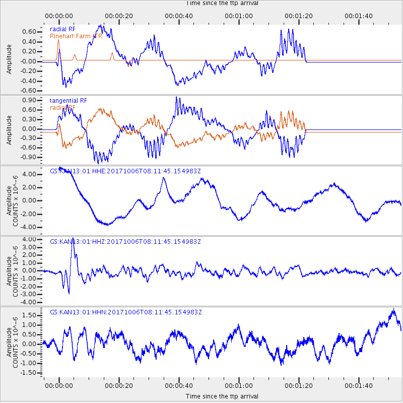
KAN13 Rinehart Farm - Earthquake Result Viewer
*The percent match for this event was below the threshold and hence no stack was calculated.
| Earthquake location: |
Off East Coast Of Honshu, Japan |
| Earthquake latitude/longitude: |
37.5/144.0 |
| Earthquake time(UTC): |
2017/10/06 (279) 07:59:33 GMT |
| Earthquake Depth: |
10 km |
| Earthquake Magnitude: |
6.0 Mww |
| Earthquake Catalog/Contributor: |
NEIC PDE/us |
|
| Network: |
GS US Geological Survey Networks |
| Station: |
KAN13 Rinehart Farm |
| Lat/Lon: |
37.01 N/97.48 W |
| Elevation: |
340 m |
|
| Distance: |
86.6 deg |
| Az: |
44.765 deg |
| Baz: |
315.586 deg |
| Ray Param: |
$rayparam |
*The percent match for this event was below the threshold and hence was not used in the summary stack. |
|
| Radial Match: |
39.195908 % |
| Radial Bump: |
400 |
| Transverse Match: |
39.08192 % |
| Transverse Bump: |
400 |
| SOD ConfigId: |
2364251 |
| Insert Time: |
2017-10-20 08:02:42.047 +0000 |
| GWidth: |
2.5 |
| Max Bumps: |
400 |
| Tol: |
0.001 |
|
Signal To Noise
| Channel | StoN | STA | LTA |
| GS:KAN13:01:HHZ:20171006T08:11:45.154983Z | 13.752484 | 1.712209E-6 | 1.245018E-7 |
| GS:KAN13:01:HHN:20171006T08:11:45.154983Z | 0.83251923 | 4.903955E-7 | 5.890501E-7 |
| GS:KAN13:01:HHE:20171006T08:11:45.154983Z | 0.5110174 | 1.4969067E-6 | 2.9292676E-6 |
| Arrivals |
| Ps | |
| PpPs | |
| PsPs/PpSs | |


