ANA XW.ANA - Earthquake Result Viewer
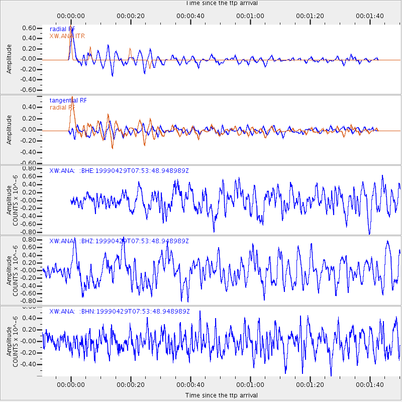
Earthquake location: Southeast Of Ryukyu Islands
Earthquake latitude/longitude: 28.9/131.1
Earthquake time(UTC): 1999/04/29 (119) 07:46:08 GMT
Earthquake Depth: 33 km
Earthquake Magnitude: 5.8 MB, 5.5 MS, 5.9 MW, 5.9 MW
Earthquake Catalog/Contributor: WHDF/NEIC
Network: XW Tien Shan Continental Dynamics
Station: ANA XW.ANA
Lat/Lon: 42.78 N/77.66 E
Elevation: 1813 m
Distance: 44.8 deg
Az: 302.93 deg
Baz: 89.966 deg
Ray Param: 0.071612224
Estimated Moho Depth: 10.75 km
Estimated Crust Vp/Vs: 1.60
Assumed Crust Vp: 6.306 km/s
Estimated Crust Vs: 3.941 km/s
Estimated Crust Poisson's Ratio: 0.18
Radial Match: 80.70654 %
Radial Bump: 400
Transverse Match: 59.173416 %
Transverse Bump: 400
SOD ConfigId: 4480
Insert Time: 2010-02-26 15:16:06.736 +0000
GWidth: 2.5
Max Bumps: 400
Tol: 0.001

Signal To Noise

ChannelStoNSTALTA
XW:ANA: :BHZ:19990429T07:53:48.948989Z3.13563514.195163E-71.337899E-7
XW:ANA: :BHN:19990429T07:53:48.948989Z0.979904831.2173798E-71.2423449E-7
XW:ANA: :BHE:19990429T07:53:48.948989Z1.73423112.6381065E-71.5211967E-7
Arrivals
Ps1.1 SECOND
PpPs4.1 SECOND
PsPs/PpSs5.2 SECOND