You are here: Home > Network List > US - United States National Seismic Network Stations List
> Station EGMT Eagleton, Montana, USA > Earthquake Result Viewer
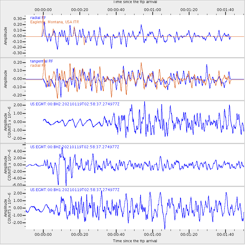
EGMT Eagleton, Montana, USA - Earthquake Result Viewer
*The percent match for this event was below the threshold and hence no stack was calculated.
| Earthquake location: |
San Juan Province, Argentina |
| Earthquake latitude/longitude: |
-31.8/-68.8 |
| Earthquake time(UTC): |
2021/01/19 (019) 02:46:22 GMT |
| Earthquake Depth: |
20 km |
| Earthquake Magnitude: |
6.4 mww |
| Earthquake Catalog/Contributor: |
NEIC PDE/us |
|
| Network: |
US United States National Seismic Network |
| Station: |
EGMT Eagleton, Montana, USA |
| Lat/Lon: |
48.02 N/109.75 W |
| Elevation: |
1055 m |
|
| Distance: |
87.5 deg |
| Az: |
333.896 deg |
| Baz: |
146.084 deg |
| Ray Param: |
$rayparam |
*The percent match for this event was below the threshold and hence was not used in the summary stack. |
|
| Radial Match: |
76.656555 % |
| Radial Bump: |
400 |
| Transverse Match: |
68.1165 % |
| Transverse Bump: |
400 |
| SOD ConfigId: |
23341671 |
| Insert Time: |
2021-02-02 04:10:34.221 +0000 |
| GWidth: |
2.5 |
| Max Bumps: |
400 |
| Tol: |
0.001 |
|
Signal To Noise
| Channel | StoN | STA | LTA |
| US:EGMT:00:BHZ:20210119T02:58:37.274977Z | 2.5452454 | 6.8608784E-7 | 2.6955666E-7 |
| US:EGMT:00:BH1:20210119T02:58:37.274977Z | 0.84867036 | 3.5315455E-7 | 4.1612685E-7 |
| US:EGMT:00:BH2:20210119T02:58:37.274977Z | 1.2734926 | 3.0588518E-7 | 2.401939E-7 |
| Arrivals |
| Ps | |
| PpPs | |
| PsPs/PpSs | |


