You are here: Home > Network List > UU - University of Utah Regional Network Stations List
> Station CCUT Cedar City, UT, USA > Earthquake Result Viewer
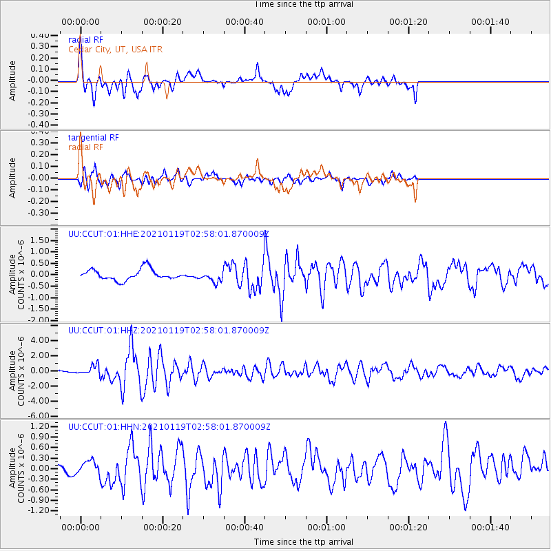
CCUT Cedar City, UT, USA - Earthquake Result Viewer
*The percent match for this event was below the threshold and hence no stack was calculated.
| Earthquake location: |
San Juan Province, Argentina |
| Earthquake latitude/longitude: |
-31.8/-68.8 |
| Earthquake time(UTC): |
2021/01/19 (019) 02:46:22 GMT |
| Earthquake Depth: |
20 km |
| Earthquake Magnitude: |
6.4 mww |
| Earthquake Catalog/Contributor: |
NEIC PDE/us |
|
| Network: |
UU University of Utah Regional Network |
| Station: |
CCUT Cedar City, UT, USA |
| Lat/Lon: |
37.55 N/113.36 W |
| Elevation: |
2127 m |
|
| Distance: |
80.6 deg |
| Az: |
325.606 deg |
| Baz: |
142.768 deg |
| Ray Param: |
$rayparam |
*The percent match for this event was below the threshold and hence was not used in the summary stack. |
|
| Radial Match: |
70.99313 % |
| Radial Bump: |
400 |
| Transverse Match: |
77.30772 % |
| Transverse Bump: |
400 |
| SOD ConfigId: |
23341671 |
| Insert Time: |
2021-02-02 04:11:31.998 +0000 |
| GWidth: |
2.5 |
| Max Bumps: |
400 |
| Tol: |
0.001 |
|
Signal To Noise
| Channel | StoN | STA | LTA |
| UU:CCUT:01:HHZ:20210119T02:58:01.870009Z | 4.124319 | 6.443264E-7 | 1.5622612E-7 |
| UU:CCUT:01:HHN:20210119T02:58:01.870009Z | 0.42326364 | 1.7382487E-7 | 4.1067753E-7 |
| UU:CCUT:01:HHE:20210119T02:58:01.870009Z | 1.0139757 | 2.3983227E-7 | 2.3652666E-7 |
| Arrivals |
| Ps | |
| PpPs | |
| PsPs/PpSs | |


