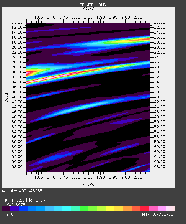
MTE GEOFON Station Manteigas, Portugal - Earthquake Result Viewer

Earthquake location: Near West Coast Of Colombia
Earthquake latitude/longitude: 4.7/-77.5
Earthquake time(UTC): 2004/11/15 (320) 09:06:56 GMT
Earthquake Depth: 15 km
Earthquake Magnitude: 6.6 MB, 7.1 MS, 7.2 MW, 7.1 MW
Earthquake Catalog/Contributor: WHDF/NEIC
Network: GE GEOFON
Station: MTE GEOFON Station Manteigas, Portugal
Lat/Lon: 40.40 N/7.54 W
Elevation: 815 m
Distance: 71.7 deg
Az: 49.068 deg
Baz: 260.401 deg
Ray Param: 0.054114208
Estimated Moho Depth: 32.0 km
Estimated Crust Vp/Vs: 1.70
Assumed Crust Vp: 6.276 km/s
Estimated Crust Vs: 3.697 km/s
Estimated Crust Poisson's Ratio: 0.23
Radial Match: 93.645355 %
Radial Bump: 400
Transverse Match: 85.71423 %
Transverse Bump: 400
SOD ConfigId: 2459
Insert Time: 2010-03-09 04:58:54.926 +0000
GWidth: 2.5
Max Bumps: 400
Tol: 0.001

Signal To Noise

ChannelStoNSTALTA
GE:MTE: :BHN:20041115T09:17:46.781008Z9.5284082.097978E-62.2018139E-7
GE:MTE: :BHE:20041115T09:17:46.781008Z41.474111.0526603E-52.538114E-7
GE:MTE: :BHZ:20041115T09:17:46.781008Z136.220952.90414E-52.1319335E-7
Arrivals
Ps3.7 SECOND
PpPs13 SECOND
PsPs/PpSs17 SECOND