You are here: Home > Network List > IU - Global Seismograph Network (GSN - IRIS/USGS) Stations List
> Station CTAO Charters Towers, Australia > Earthquake Result Viewer
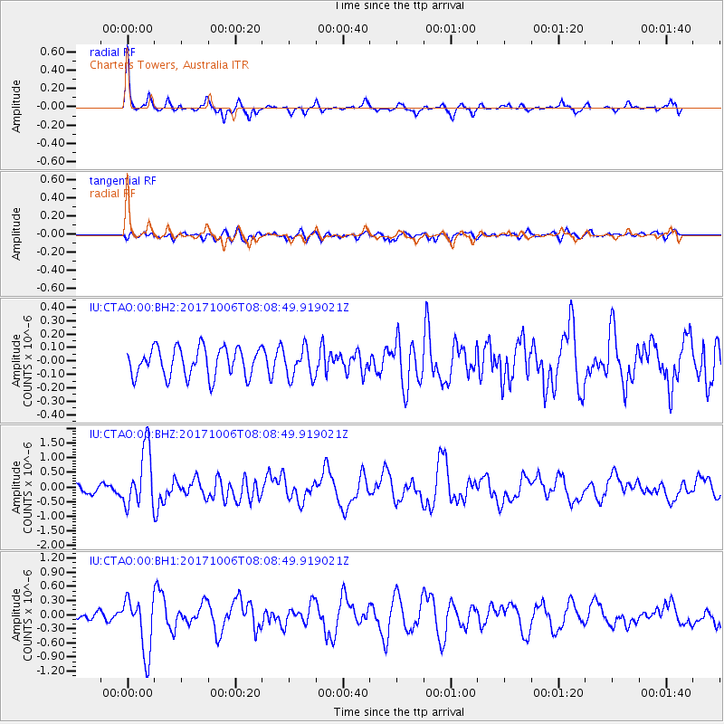
CTAO Charters Towers, Australia - Earthquake Result Viewer
*The percent match for this event was below the threshold and hence no stack was calculated.
| Earthquake location: |
Off East Coast Of Honshu, Japan |
| Earthquake latitude/longitude: |
37.5/144.0 |
| Earthquake time(UTC): |
2017/10/06 (279) 07:59:33 GMT |
| Earthquake Depth: |
10 km |
| Earthquake Magnitude: |
6.0 Mww |
| Earthquake Catalog/Contributor: |
NEIC PDE/us |
|
| Network: |
IU Global Seismograph Network (GSN - IRIS/USGS) |
| Station: |
CTAO Charters Towers, Australia |
| Lat/Lon: |
20.09 S/146.25 E |
| Elevation: |
357 m |
|
| Distance: |
57.3 deg |
| Az: |
177.43 deg |
| Baz: |
357.825 deg |
| Ray Param: |
$rayparam |
*The percent match for this event was below the threshold and hence was not used in the summary stack. |
|
| Radial Match: |
79.14566 % |
| Radial Bump: |
298 |
| Transverse Match: |
63.41969 % |
| Transverse Bump: |
400 |
| SOD ConfigId: |
2364251 |
| Insert Time: |
2017-10-20 08:03:45.209 +0000 |
| GWidth: |
2.5 |
| Max Bumps: |
400 |
| Tol: |
0.001 |
|
Signal To Noise
| Channel | StoN | STA | LTA |
| IU:CTAO:00:BHZ:20171006T08:08:49.919021Z | 5.809659 | 1.0030043E-6 | 1.7264426E-7 |
| IU:CTAO:00:BH1:20171006T08:08:49.919021Z | 5.64977 | 5.95755E-7 | 1.0544767E-7 |
| IU:CTAO:00:BH2:20171006T08:08:49.919021Z | 1.0361031 | 1.11214035E-7 | 1.0733877E-7 |
| Arrivals |
| Ps | |
| PpPs | |
| PsPs/PpSs | |


