You are here: Home > Network List > TA - USArray Transportable Network (new EarthScope stations) Stations List
> Station R31K City Hall, Gustavus, AK, USA > Earthquake Result Viewer
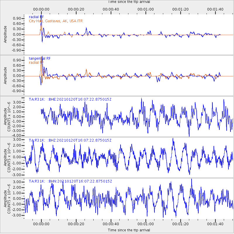
R31K City Hall, Gustavus, AK, USA - Earthquake Result Viewer
*The percent match for this event was below the threshold and hence no stack was calculated.
| Earthquake location: |
Sea Of Okhotsk |
| Earthquake latitude/longitude: |
49.7/147.7 |
| Earthquake time(UTC): |
2021/01/20 (020) 16:00:40 GMT |
| Earthquake Depth: |
575 km |
| Earthquake Magnitude: |
5.5 Mww |
| Earthquake Catalog/Contributor: |
NEIC PDE/us |
|
| Network: |
TA USArray Transportable Network (new EarthScope stations) |
| Station: |
R31K City Hall, Gustavus, AK, USA |
| Lat/Lon: |
58.41 N/135.74 W |
| Elevation: |
15 m |
|
| Distance: |
43.4 deg |
| Az: |
48.15 deg |
| Baz: |
293.296 deg |
| Ray Param: |
$rayparam |
*The percent match for this event was below the threshold and hence was not used in the summary stack. |
|
| Radial Match: |
50.06101 % |
| Radial Bump: |
400 |
| Transverse Match: |
75.00964 % |
| Transverse Bump: |
400 |
| SOD ConfigId: |
23341671 |
| Insert Time: |
2021-02-03 17:18:41.593 +0000 |
| GWidth: |
2.5 |
| Max Bumps: |
400 |
| Tol: |
0.001 |
|
Signal To Noise
| Channel | StoN | STA | LTA |
| TA:R31K: :BHZ:20210120T16:07:22.875015Z | 1.6910427 | 1.2635156E-6 | 7.4718145E-7 |
| TA:R31K: :BHN:20210120T16:07:22.875015Z | 1.2514176 | 1.1432221E-6 | 9.1354156E-7 |
| TA:R31K: :BHE:20210120T16:07:22.875015Z | 1.1388264 | 1.1227719E-6 | 9.859026E-7 |
| Arrivals |
| Ps | |
| PpPs | |
| PsPs/PpSs | |


