You are here: Home > Network List > US - United States National Seismic Network Stations List
> Station WMOK Wichita Mountains, Oklahoma, USA > Earthquake Result Viewer
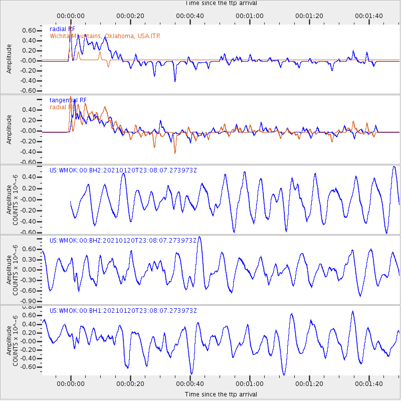
WMOK Wichita Mountains, Oklahoma, USA - Earthquake Result Viewer
*The percent match for this event was below the threshold and hence no stack was calculated.
| Earthquake location: |
Near Coast Of Peru |
| Earthquake latitude/longitude: |
-15.0/-75.5 |
| Earthquake time(UTC): |
2021/01/20 (020) 22:59:12 GMT |
| Earthquake Depth: |
10 km |
| Earthquake Magnitude: |
5.5 Mww |
| Earthquake Catalog/Contributor: |
NEIC PDE/us |
|
| Network: |
US United States National Seismic Network |
| Station: |
WMOK Wichita Mountains, Oklahoma, USA |
| Lat/Lon: |
34.74 N/98.78 W |
| Elevation: |
486 m |
|
| Distance: |
54.2 deg |
| Az: |
336.354 deg |
| Baz: |
151.928 deg |
| Ray Param: |
$rayparam |
*The percent match for this event was below the threshold and hence was not used in the summary stack. |
|
| Radial Match: |
46.616577 % |
| Radial Bump: |
400 |
| Transverse Match: |
59.942745 % |
| Transverse Bump: |
400 |
| SOD ConfigId: |
23341671 |
| Insert Time: |
2021-02-04 00:14:48.890 +0000 |
| GWidth: |
2.5 |
| Max Bumps: |
400 |
| Tol: |
0.001 |
|
Signal To Noise
| Channel | StoN | STA | LTA |
| US:WMOK:00:BHZ:20210120T23:08:07.273973Z | 0.9853801 | 2.8401058E-7 | 2.8822438E-7 |
| US:WMOK:00:BH1:20210120T23:08:07.273973Z | 1.1550215 | 4.548518E-7 | 3.9380373E-7 |
| US:WMOK:00:BH2:20210120T23:08:07.273973Z | 0.59246695 | 1.368796E-7 | 2.3103331E-7 |
| Arrivals |
| Ps | |
| PpPs | |
| PsPs/PpSs | |


