ANA XW.ANA - Earthquake Result Viewer
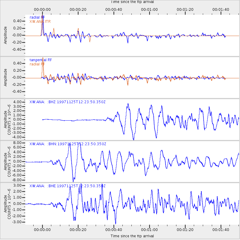
Earthquake location: Minahassa Peninsula, Sulawesi
Earthquake latitude/longitude: 1.2/122.5
Earthquake time(UTC): 1997/11/25 (329) 12:14:33 GMT
Earthquake Depth: 24 km
Earthquake Magnitude: 6.1 MB, 6.8 MS, 7.1 UNKNOWN, 6.7 ME
Earthquake Catalog/Contributor: WHDF/NEIC
Network: XW Tien Shan Continental Dynamics
Station: ANA XW.ANA
Lat/Lon: 42.78 N/77.66 E
Elevation: 1813 m
Distance: 57.6 deg
Az: 322.022 deg
Baz: 123.313 deg
Ray Param: 0.06336606
Estimated Moho Depth: 43.75 km
Estimated Crust Vp/Vs: 1.60
Assumed Crust Vp: 6.306 km/s
Estimated Crust Vs: 3.941 km/s
Estimated Crust Poisson's Ratio: 0.18
Radial Match: 90.7027 %
Radial Bump: 400
Transverse Match: 81.19707 %
Transverse Bump: 400
SOD ConfigId: 4480
Insert Time: 2010-02-26 15:16:25.259 +0000
GWidth: 2.5
Max Bumps: 400
Tol: 0.001

Signal To Noise

ChannelStoNSTALTA
XW:ANA: :BHN:19971125T12:23:50.350Z4.5479411.5723603E-73.4573013E-8
XW:ANA: :BHE:19971125T12:23:50.350Z0.85826164.299401E-85.0094297E-8
XW:ANA: :BHZ:19971125T12:23:50.350Z0.467437364.42532E-89.467193E-8
Arrivals
Ps4.4 SECOND
PpPs17 SECOND
PsPs/PpSs21 SECOND