You are here: Home > Network List > AV - Alaska Volcano Observatory Stations List
> Station KAVE Katnai Ventifact, Alaska > Earthquake Result Viewer
KAVE Katnai Ventifact, Alaska - Earthquake Result Viewer
*The percent match for this event was below the threshold and hence no stack was calculated.
| Earthquake location: |
Philippine Islands Region |
| Earthquake latitude/longitude: |
5.0/127.5 |
| Earthquake time(UTC): |
2021/01/21 (021) 12:23:05 GMT |
| Earthquake Depth: |
96 km |
| Earthquake Magnitude: |
7.0 mww |
| Earthquake Catalog/Contributor: |
NEIC PDE/us |
|
| Network: |
AV Alaska Volcano Observatory |
| Station: |
KAVE Katnai Ventifact, Alaska |
| Lat/Lon: |
58.20 N/155.02 W |
| Elevation: |
702 m |
|
| Distance: |
79.2 deg |
| Az: |
31.756 deg |
| Baz: |
261.947 deg |
| Ray Param: |
$rayparam |
*The percent match for this event was below the threshold and hence was not used in the summary stack. |
|
| Radial Match: |
75.631546 % |
| Radial Bump: |
400 |
| Transverse Match: |
68.57414 % |
| Transverse Bump: |
400 |
| SOD ConfigId: |
23341671 |
| Insert Time: |
2021-02-04 13:31:13.723 +0000 |
| GWidth: |
2.5 |
| Max Bumps: |
400 |
| Tol: |
0.001 |
|
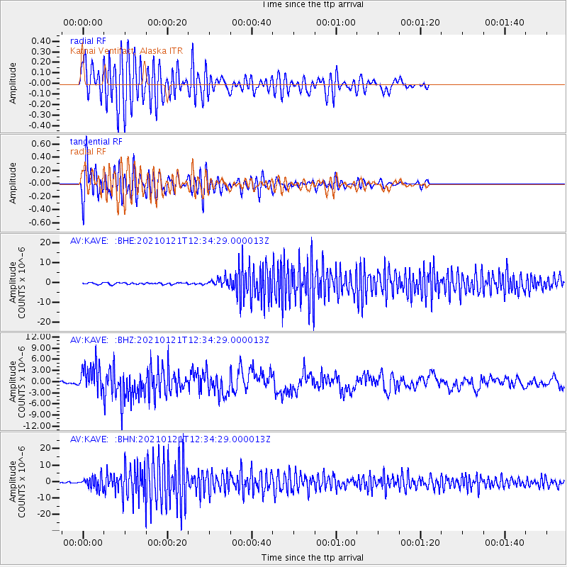
Signal To Noise
| Channel | StoN | STA | LTA |
| AV:KAVE: :BHZ:20210121T12:34:29.000013Z | 6.104697 | 3.7299756E-6 | 6.1100087E-7 |
| AV:KAVE: :BHN:20210121T12:34:29.000013Z | 5.8291936 | 3.6587599E-6 | 6.276614E-7 |
| AV:KAVE: :BHE:20210121T12:34:29.000013Z | 4.708578 | 1.9165834E-6 | 4.0704077E-7 |
| Arrivals |
| Ps | |
| PpPs | |
| PsPs/PpSs | |


