You are here: Home > Network List > G - GEOSCOPE Stations List
> Station TAOE Taiohae, Marquises islands > Earthquake Result Viewer
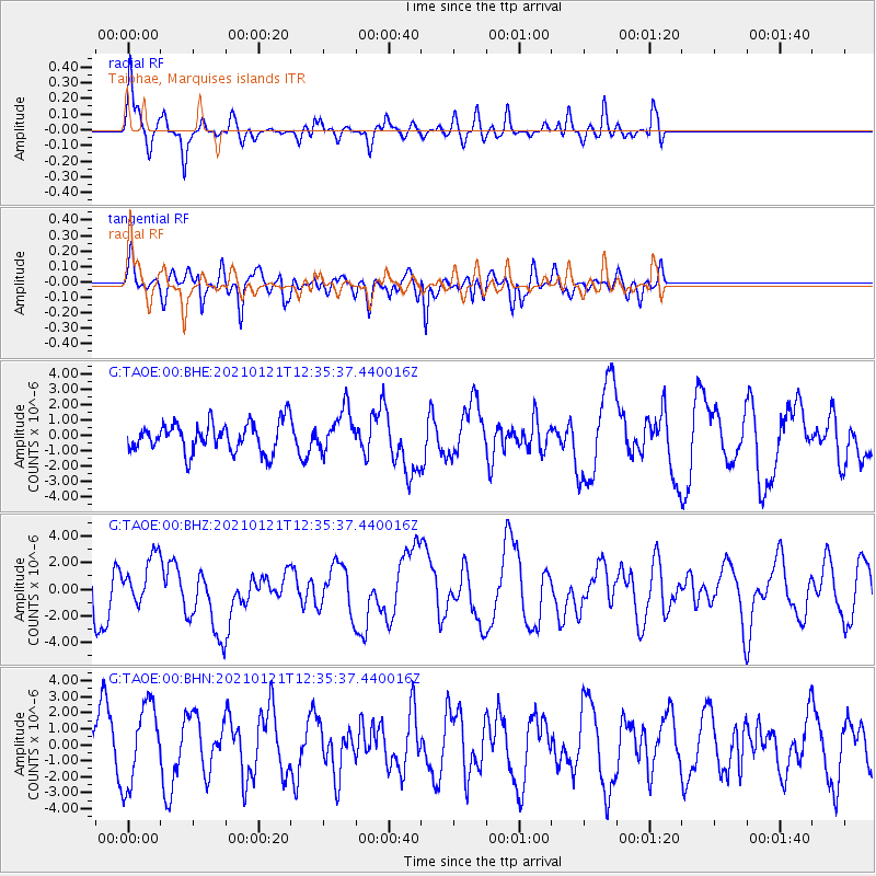
TAOE Taiohae, Marquises islands - Earthquake Result Viewer
*The percent match for this event was below the threshold and hence no stack was calculated.
| Earthquake location: |
Philippine Islands Region |
| Earthquake latitude/longitude: |
5.0/127.5 |
| Earthquake time(UTC): |
2021/01/21 (021) 12:23:05 GMT |
| Earthquake Depth: |
96 km |
| Earthquake Magnitude: |
7.0 mww |
| Earthquake Catalog/Contributor: |
NEIC PDE/us |
|
| Network: |
G GEOSCOPE |
| Station: |
TAOE Taiohae, Marquises islands |
| Lat/Lon: |
8.85 S/140.15 W |
| Elevation: |
800 m |
|
| Distance: |
93.1 deg |
| Az: |
98.573 deg |
| Baz: |
274.565 deg |
| Ray Param: |
$rayparam |
*The percent match for this event was below the threshold and hence was not used in the summary stack. |
|
| Radial Match: |
67.49619 % |
| Radial Bump: |
386 |
| Transverse Match: |
55.644073 % |
| Transverse Bump: |
394 |
| SOD ConfigId: |
23341671 |
| Insert Time: |
2021-02-04 13:32:51.668 +0000 |
| GWidth: |
2.5 |
| Max Bumps: |
400 |
| Tol: |
0.001 |
|
Signal To Noise
| Channel | StoN | STA | LTA |
| G:TAOE:00:BHZ:20210121T12:35:37.440016Z | 1.2058535 | 1.7927983E-6 | 1.4867466E-6 |
| G:TAOE:00:BHN:20210121T12:35:37.440016Z | 1.5062546 | 2.514783E-6 | 1.6695603E-6 |
| G:TAOE:00:BHE:20210121T12:35:37.440016Z | 1.4344097 | 1.3752954E-6 | 9.587884E-7 |
| Arrivals |
| Ps | |
| PpPs | |
| PsPs/PpSs | |


