You are here: Home > Network List > IU - Global Seismograph Network (GSN - IRIS/USGS) Stations List
> Station PMG Port Moresby, New Guinea > Earthquake Result Viewer
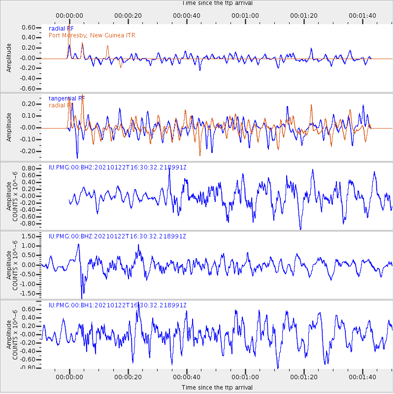
PMG Port Moresby, New Guinea - Earthquake Result Viewer
*The percent match for this event was below the threshold and hence no stack was calculated.
| Earthquake location: |
South Of Kermadec Islands |
| Earthquake latitude/longitude: |
-33.2/-179.5 |
| Earthquake time(UTC): |
2021/01/22 (022) 16:23:42 GMT |
| Earthquake Depth: |
46 km |
| Earthquake Magnitude: |
5.6 Mww |
| Earthquake Catalog/Contributor: |
NEIC PDE/us |
|
| Network: |
IU Global Seismograph Network (GSN - IRIS/USGS) |
| Station: |
PMG Port Moresby, New Guinea |
| Lat/Lon: |
9.40 S/147.16 E |
| Elevation: |
90 m |
|
| Distance: |
38.8 deg |
| Az: |
299.937 deg |
| Baz: |
132.547 deg |
| Ray Param: |
$rayparam |
*The percent match for this event was below the threshold and hence was not used in the summary stack. |
|
| Radial Match: |
44.28551 % |
| Radial Bump: |
400 |
| Transverse Match: |
49.242054 % |
| Transverse Bump: |
362 |
| SOD ConfigId: |
23341671 |
| Insert Time: |
2021-02-05 17:32:31.122 +0000 |
| GWidth: |
2.5 |
| Max Bumps: |
400 |
| Tol: |
0.001 |
|
Signal To Noise
| Channel | StoN | STA | LTA |
| IU:PMG:00:BHZ:20210122T16:30:32.218991Z | 3.7200465 | 6.5017736E-7 | 1.7477667E-7 |
| IU:PMG:00:BH1:20210122T16:30:32.218991Z | 0.62738574 | 1.4442058E-7 | 2.3019423E-7 |
| IU:PMG:00:BH2:20210122T16:30:32.218991Z | 1.5740259 | 2.436221E-7 | 1.5477643E-7 |
| Arrivals |
| Ps | |
| PpPs | |
| PsPs/PpSs | |


