You are here: Home > Network List > US - United States National Seismic Network Stations List
> Station ELK Elko, Nevada, USA > Earthquake Result Viewer
ELK Elko, Nevada, USA - Earthquake Result Viewer
*The percent match for this event was below the threshold and hence no stack was calculated.
| Earthquake location: |
South Of Kermadec Islands |
| Earthquake latitude/longitude: |
-33.2/-179.5 |
| Earthquake time(UTC): |
2021/01/22 (022) 16:23:42 GMT |
| Earthquake Depth: |
46 km |
| Earthquake Magnitude: |
5.6 Mww |
| Earthquake Catalog/Contributor: |
NEIC PDE/us |
|
| Network: |
US United States National Seismic Network |
| Station: |
ELK Elko, Nevada, USA |
| Lat/Lon: |
40.74 N/115.24 W |
| Elevation: |
2210 m |
|
| Distance: |
94.4 deg |
| Az: |
43.342 deg |
| Baz: |
229.271 deg |
| Ray Param: |
$rayparam |
*The percent match for this event was below the threshold and hence was not used in the summary stack. |
|
| Radial Match: |
56.709103 % |
| Radial Bump: |
285 |
| Transverse Match: |
61.86649 % |
| Transverse Bump: |
400 |
| SOD ConfigId: |
23341671 |
| Insert Time: |
2021-02-05 17:35:27.777 +0000 |
| GWidth: |
2.5 |
| Max Bumps: |
400 |
| Tol: |
0.001 |
|
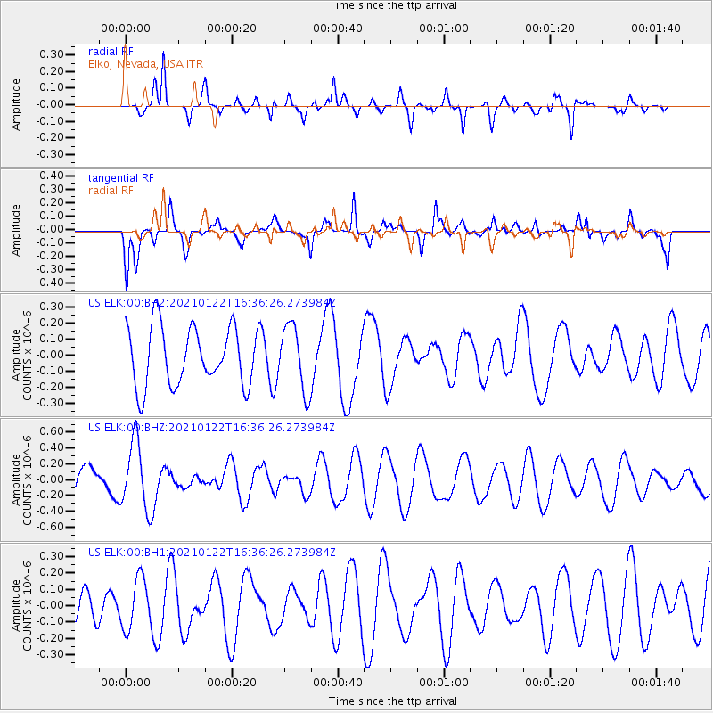
Signal To Noise
| Channel | StoN | STA | LTA |
| US:ELK:00:BHZ:20210122T16:36:26.273984Z | 2.499038 | 4.279614E-7 | 1.7125046E-7 |
| US:ELK:00:BH1:20210122T16:36:26.273984Z | 0.98996407 | 1.5687746E-7 | 1.5846783E-7 |
| US:ELK:00:BH2:20210122T16:36:26.273984Z | 1.1383892 | 2.0596202E-7 | 1.8092409E-7 |
| Arrivals |
| Ps | |
| PpPs | |
| PsPs/PpSs | |


