You are here: Home > Network List > IU - Global Seismograph Network (GSN - IRIS/USGS) Stations List
> Station PMG Port Moresby, New Guinea > Earthquake Result Viewer
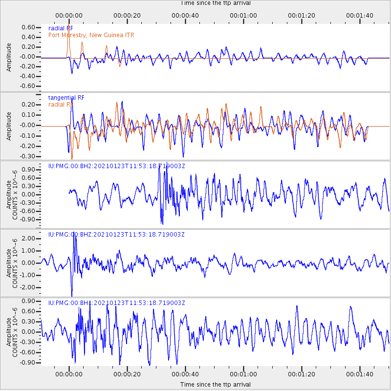
PMG Port Moresby, New Guinea - Earthquake Result Viewer
*The percent match for this event was below the threshold and hence no stack was calculated.
| Earthquake location: |
South Of Fiji Islands |
| Earthquake latitude/longitude: |
-24.3/-179.5 |
| Earthquake time(UTC): |
2021/01/23 (023) 11:47:33 GMT |
| Earthquake Depth: |
425 km |
| Earthquake Magnitude: |
5.5 mww |
| Earthquake Catalog/Contributor: |
NEIC PDE/us |
|
| Network: |
IU Global Seismograph Network (GSN - IRIS/USGS) |
| Station: |
PMG Port Moresby, New Guinea |
| Lat/Lon: |
9.40 S/147.16 E |
| Elevation: |
90 m |
|
| Distance: |
35.1 deg |
| Az: |
289.278 deg |
| Baz: |
119.232 deg |
| Ray Param: |
$rayparam |
*The percent match for this event was below the threshold and hence was not used in the summary stack. |
|
| Radial Match: |
67.55727 % |
| Radial Bump: |
400 |
| Transverse Match: |
58.21839 % |
| Transverse Bump: |
400 |
| SOD ConfigId: |
23341671 |
| Insert Time: |
2021-02-06 12:56:47.426 +0000 |
| GWidth: |
2.5 |
| Max Bumps: |
400 |
| Tol: |
0.001 |
|
Signal To Noise
| Channel | StoN | STA | LTA |
| IU:PMG:00:BHZ:20210123T11:53:18.719003Z | 3.4469333 | 1.1156083E-6 | 3.236524E-7 |
| IU:PMG:00:BH1:20210123T11:53:18.719003Z | 2.251239 | 3.7247813E-7 | 1.6545472E-7 |
| IU:PMG:00:BH2:20210123T11:53:18.719003Z | 2.1156406 | 5.4687683E-7 | 2.584923E-7 |
| Arrivals |
| Ps | |
| PpPs | |
| PsPs/PpSs | |


