You are here: Home > Network List > US - United States National Seismic Network Stations List
> Station AMTX Amarillo, Texas, USA > Earthquake Result Viewer
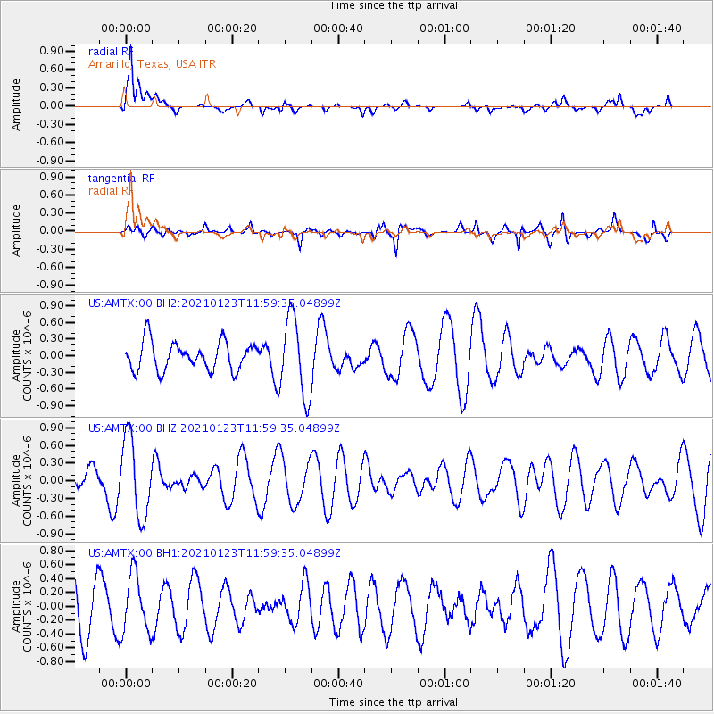
AMTX Amarillo, Texas, USA - Earthquake Result Viewer
*The percent match for this event was below the threshold and hence no stack was calculated.
| Earthquake location: |
South Of Fiji Islands |
| Earthquake latitude/longitude: |
-24.3/-179.5 |
| Earthquake time(UTC): |
2021/01/23 (023) 11:47:33 GMT |
| Earthquake Depth: |
425 km |
| Earthquake Magnitude: |
5.5 mww |
| Earthquake Catalog/Contributor: |
NEIC PDE/us |
|
| Network: |
US United States National Seismic Network |
| Station: |
AMTX Amarillo, Texas, USA |
| Lat/Lon: |
34.53 N/101.41 W |
| Elevation: |
1010 m |
|
| Distance: |
94.3 deg |
| Az: |
54.113 deg |
| Baz: |
243.532 deg |
| Ray Param: |
$rayparam |
*The percent match for this event was below the threshold and hence was not used in the summary stack. |
|
| Radial Match: |
74.39841 % |
| Radial Bump: |
400 |
| Transverse Match: |
57.96437 % |
| Transverse Bump: |
400 |
| SOD ConfigId: |
23341671 |
| Insert Time: |
2021-02-06 13:01:34.458 +0000 |
| GWidth: |
2.5 |
| Max Bumps: |
400 |
| Tol: |
0.001 |
|
Signal To Noise
| Channel | StoN | STA | LTA |
| US:AMTX:00:BHZ:20210123T11:59:35.04899Z | 2.3335779 | 6.721777E-7 | 2.8804595E-7 |
| US:AMTX:00:BH1:20210123T11:59:35.04899Z | 1.308693 | 4.221236E-7 | 3.2255357E-7 |
| US:AMTX:00:BH2:20210123T11:59:35.04899Z | 2.7947812 | 7.1360813E-7 | 2.5533595E-7 |
| Arrivals |
| Ps | |
| PpPs | |
| PsPs/PpSs | |


