KBS IRIS/GEOFON/AWI Station Ny Alesund, Spitsbergen - Earthquake Result Viewer
Earthquake location: Southern Sumatra, Indonesia
Earthquake latitude/longitude: -0.5/99.3
Earthquake time(UTC): 1998/04/01 (091) 17:56:23 GMT
Earthquake Depth: 56 km
Earthquake Magnitude: 6.2 MB, 6.9 MS, 7.0 UNKNOWN, 6.6 ME
Earthquake Catalog/Contributor: WHDF/NEIC
Network: GE GEOFON
Station: KBS IRIS/GEOFON/AWI Station Ny Alesund, Spitsbergen
Lat/Lon: 78.93 N/11.94 E
Elevation: 77 m
Distance: 90.0 deg
Az: 348.865 deg
Baz: 92.735 deg
Ray Param: 0.041694544
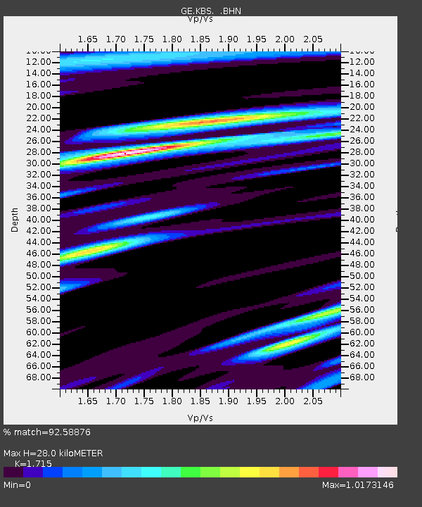
Estimated Moho Depth: 28.0 km
Estimated Crust Vp/Vs: 1.72
Assumed Crust Vp: 6.287 km/s
Estimated Crust Vs: 3.666 km/s
Estimated Crust Poisson's Ratio: 0.24
Radial Match: 92.58876 %
Radial Bump: 400
Transverse Match: 79.7768 %
Transverse Bump: 400
SOD ConfigId: 4480
Insert Time: 2010-03-09 05:03:36.139 +0000
GWidth: 2.5
Max Bumps: 400
Tol: 0.001

Signal To Noise

ChannelStoNSTALTA
GE:KBS: :BHN:19980401T18:08:45.578015Z10.7817592.5780707E-62.391141E-7
GE:KBS: :BHE:19980401T18:08:45.578015Z1.24229442.9893982E-72.4063525E-7
GE:KBS: :BHZ:19980401T18:08:45.578015Z6.9351429.436478E-71.3606756E-7
Arrivals
Ps3.3 SECOND
PpPs12 SECOND
PsPs/PpSs15 SECOND