You are here: Home > Network List > US - United States National Seismic Network Stations List
> Station WMOK Wichita Mountains, Oklahoma, USA > Earthquake Result Viewer
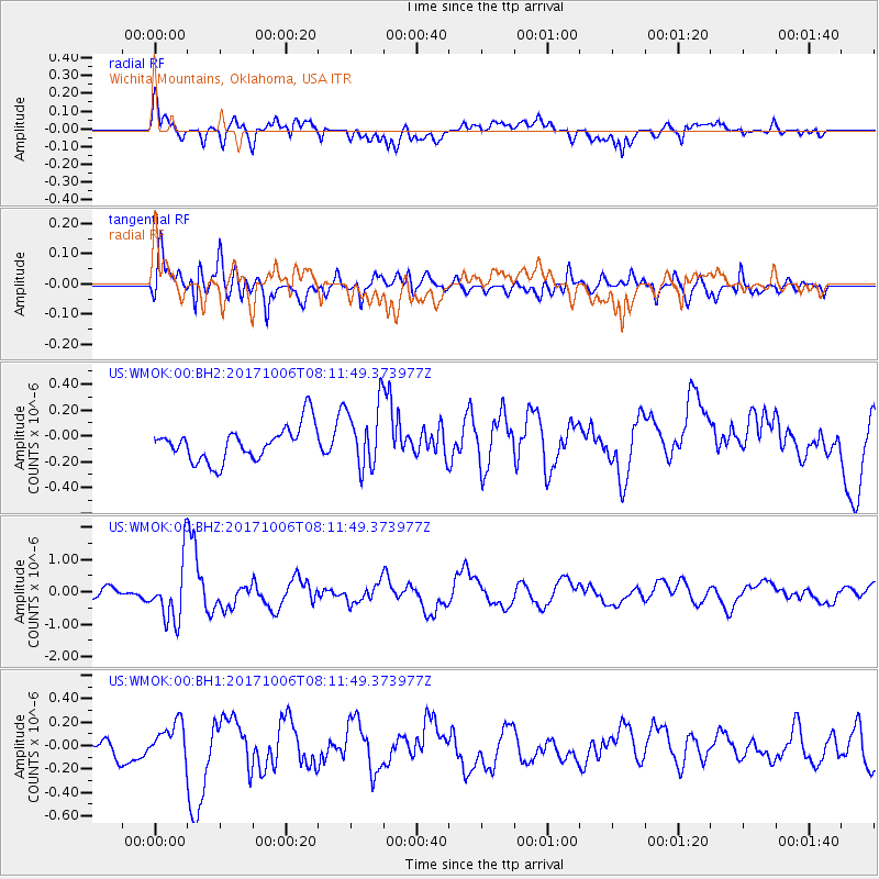
WMOK Wichita Mountains, Oklahoma, USA - Earthquake Result Viewer
*The percent match for this event was below the threshold and hence no stack was calculated.
| Earthquake location: |
Off East Coast Of Honshu, Japan |
| Earthquake latitude/longitude: |
37.5/144.0 |
| Earthquake time(UTC): |
2017/10/06 (279) 07:59:33 GMT |
| Earthquake Depth: |
10 km |
| Earthquake Magnitude: |
6.0 Mww |
| Earthquake Catalog/Contributor: |
NEIC PDE/us |
|
| Network: |
US United States National Seismic Network |
| Station: |
WMOK Wichita Mountains, Oklahoma, USA |
| Lat/Lon: |
34.74 N/98.78 W |
| Elevation: |
486 m |
|
| Distance: |
87.5 deg |
| Az: |
47.117 deg |
| Baz: |
314.946 deg |
| Ray Param: |
$rayparam |
*The percent match for this event was below the threshold and hence was not used in the summary stack. |
|
| Radial Match: |
64.75525 % |
| Radial Bump: |
400 |
| Transverse Match: |
70.40077 % |
| Transverse Bump: |
400 |
| SOD ConfigId: |
2364251 |
| Insert Time: |
2017-10-20 08:09:05.376 +0000 |
| GWidth: |
2.5 |
| Max Bumps: |
400 |
| Tol: |
0.001 |
|
Signal To Noise
| Channel | StoN | STA | LTA |
| US:WMOK:00:BHZ:20171006T08:11:49.373977Z | 6.4537206 | 9.289792E-7 | 1.4394476E-7 |
| US:WMOK:00:BH1:20171006T08:11:49.373977Z | 1.0870025 | 1.3172313E-7 | 1.2118015E-7 |
| US:WMOK:00:BH2:20171006T08:11:49.373977Z | 1.8474123 | 2.4644632E-7 | 1.334008E-7 |
| Arrivals |
| Ps | |
| PpPs | |
| PsPs/PpSs | |


