You are here: Home > Network List > AV - Alaska Volcano Observatory Stations List
> Station MAPS Pakushin Southeast, Makushin Volcano, Alaska > Earthquake Result Viewer
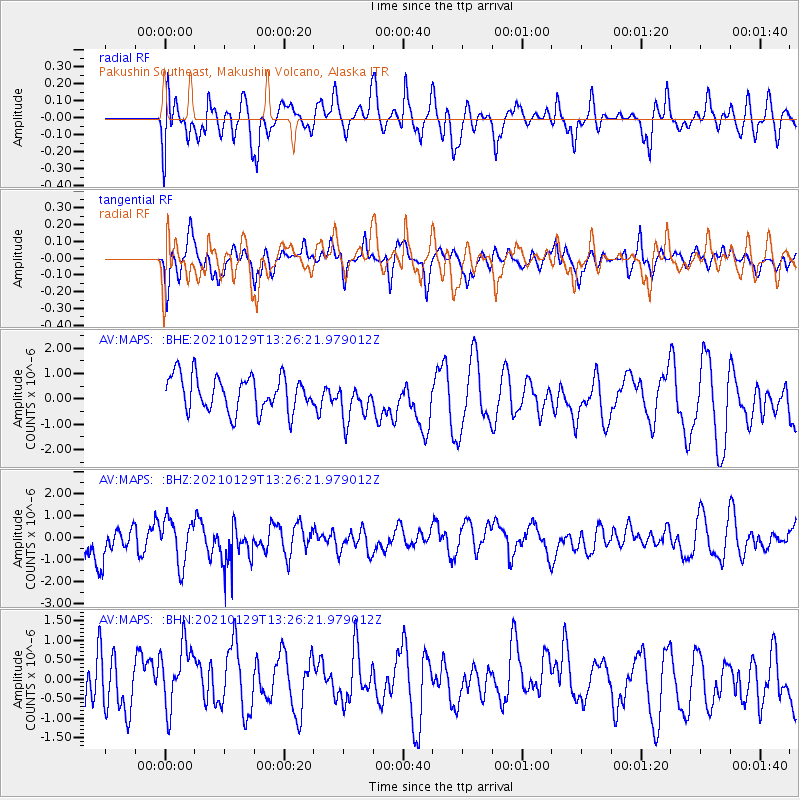
MAPS Pakushin Southeast, Makushin Volcano, Alaska - Earthquake Result Viewer
*The percent match for this event was below the threshold and hence no stack was calculated.
| Earthquake location: |
Panama-Costa Rica Border Region |
| Earthquake latitude/longitude: |
8.3/-83.0 |
| Earthquake time(UTC): |
2021/01/29 (029) 13:14:44 GMT |
| Earthquake Depth: |
10 km |
| Earthquake Magnitude: |
5.5 Mww |
| Earthquake Catalog/Contributor: |
NEIC PDE/us |
|
| Network: |
AV Alaska Volcano Observatory |
| Station: |
MAPS Pakushin Southeast, Makushin Volcano, Alaska |
| Lat/Lon: |
53.81 N/166.94 W |
| Elevation: |
333 m |
|
| Distance: |
79.8 deg |
| Az: |
323.185 deg |
| Baz: |
89.922 deg |
| Ray Param: |
$rayparam |
*The percent match for this event was below the threshold and hence was not used in the summary stack. |
|
| Radial Match: |
58.245785 % |
| Radial Bump: |
400 |
| Transverse Match: |
57.054844 % |
| Transverse Bump: |
400 |
| SOD ConfigId: |
23341671 |
| Insert Time: |
2021-02-12 14:18:20.475 +0000 |
| GWidth: |
2.5 |
| Max Bumps: |
400 |
| Tol: |
0.001 |
|
Signal To Noise
| Channel | StoN | STA | LTA |
| AV:MAPS: :BHZ:20210129T13:26:21.979012Z | 1.2107419 | 1.0105654E-6 | 8.3466625E-7 |
| AV:MAPS: :BHN:20210129T13:26:21.979012Z | 1.3289126 | 8.659787E-7 | 6.5164454E-7 |
| AV:MAPS: :BHE:20210129T13:26:21.979012Z | 1.1310021 | 7.767931E-7 | 6.8681845E-7 |
| Arrivals |
| Ps | |
| PpPs | |
| PsPs/PpSs | |


