You are here: Home > Network List > IU - Global Seismograph Network (GSN - IRIS/USGS) Stations List
> Station RSSD Black Hills, South Dakota, USA > Earthquake Result Viewer
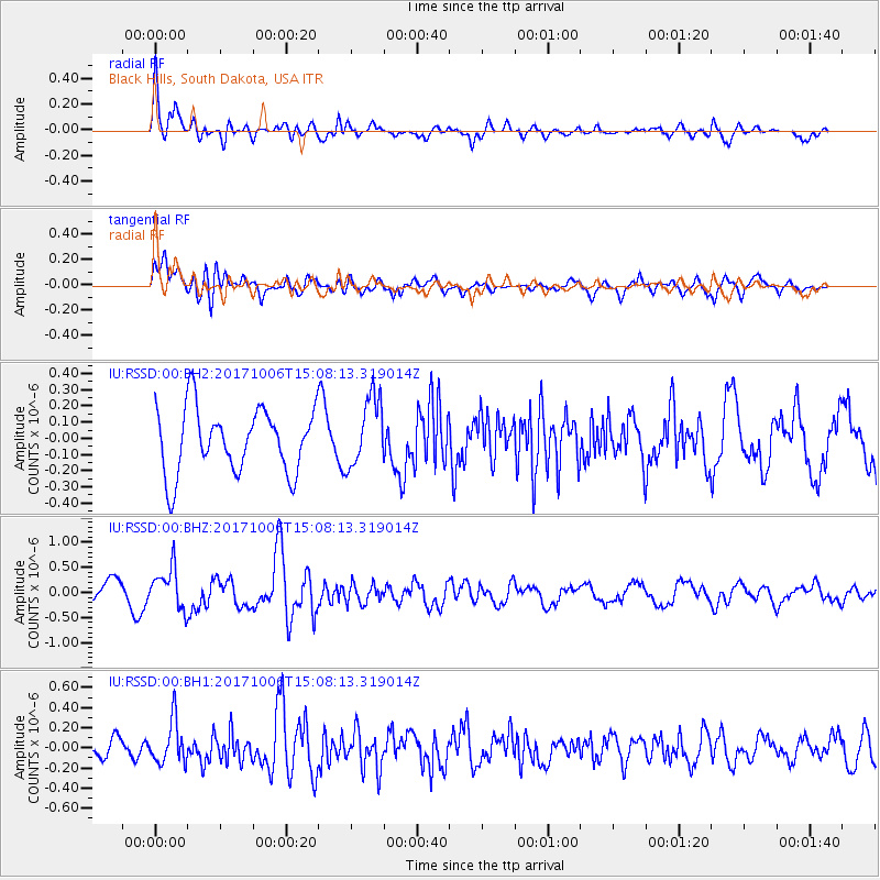
RSSD Black Hills, South Dakota, USA - Earthquake Result Viewer
*The percent match for this event was below the threshold and hence no stack was calculated.
| Earthquake location: |
Near East Coast Of Honshu, Japan |
| Earthquake latitude/longitude: |
37.1/141.2 |
| Earthquake time(UTC): |
2017/10/06 (279) 14:56:40 GMT |
| Earthquake Depth: |
47 km |
| Earthquake Magnitude: |
5.4 Mww |
| Earthquake Catalog/Contributor: |
NEIC PDE/us |
|
| Network: |
IU Global Seismograph Network (GSN - IRIS/USGS) |
| Station: |
RSSD Black Hills, South Dakota, USA |
| Lat/Lon: |
44.12 N/104.04 W |
| Elevation: |
2090 m |
|
| Distance: |
79.9 deg |
| Az: |
41.626 deg |
| Baz: |
312.487 deg |
| Ray Param: |
$rayparam |
*The percent match for this event was below the threshold and hence was not used in the summary stack. |
|
| Radial Match: |
77.99375 % |
| Radial Bump: |
400 |
| Transverse Match: |
77.17354 % |
| Transverse Bump: |
400 |
| SOD ConfigId: |
2364251 |
| Insert Time: |
2017-10-20 14:58:59.845 +0000 |
| GWidth: |
2.5 |
| Max Bumps: |
400 |
| Tol: |
0.001 |
|
Signal To Noise
| Channel | StoN | STA | LTA |
| IU:RSSD:00:BHZ:20171006T15:08:13.319014Z | 1.8915589 | 4.104292E-7 | 2.1697936E-7 |
| IU:RSSD:00:BH1:20171006T15:08:13.319014Z | 2.1850057 | 2.1293903E-7 | 9.745468E-8 |
| IU:RSSD:00:BH2:20171006T15:08:13.319014Z | 1.0893655 | 2.1639325E-7 | 1.9864154E-7 |
| Arrivals |
| Ps | |
| PpPs | |
| PsPs/PpSs | |


