You are here: Home > Network List > IW - Intermountain West Stations List
> Station IMW Indian Meadow, Wyoming, USA > Earthquake Result Viewer
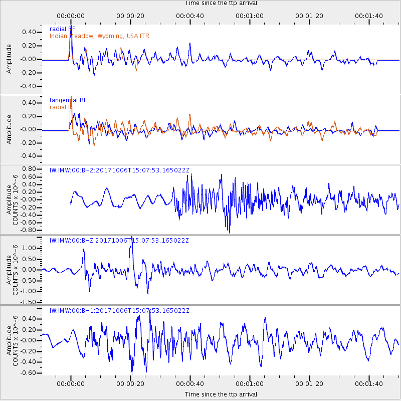
IMW Indian Meadow, Wyoming, USA - Earthquake Result Viewer
*The percent match for this event was below the threshold and hence no stack was calculated.
| Earthquake location: |
Near East Coast Of Honshu, Japan |
| Earthquake latitude/longitude: |
37.1/141.2 |
| Earthquake time(UTC): |
2017/10/06 (279) 14:56:40 GMT |
| Earthquake Depth: |
47 km |
| Earthquake Magnitude: |
5.4 Mww |
| Earthquake Catalog/Contributor: |
NEIC PDE/us |
|
| Network: |
IW Intermountain West |
| Station: |
IMW Indian Meadow, Wyoming, USA |
| Lat/Lon: |
43.90 N/110.94 W |
| Elevation: |
2646 m |
|
| Distance: |
76.2 deg |
| Az: |
45.102 deg |
| Baz: |
308.424 deg |
| Ray Param: |
$rayparam |
*The percent match for this event was below the threshold and hence was not used in the summary stack. |
|
| Radial Match: |
70.916466 % |
| Radial Bump: |
400 |
| Transverse Match: |
61.36794 % |
| Transverse Bump: |
400 |
| SOD ConfigId: |
2364251 |
| Insert Time: |
2017-10-20 14:59:10.079 +0000 |
| GWidth: |
2.5 |
| Max Bumps: |
400 |
| Tol: |
0.001 |
|
Signal To Noise
| Channel | StoN | STA | LTA |
| IW:IMW:00:BHZ:20171006T15:07:53.165022Z | 3.08799 | 3.1348367E-7 | 1.0151707E-7 |
| IW:IMW:00:BH1:20171006T15:07:53.165022Z | 1.4936306 | 1.715596E-7 | 1.14860796E-7 |
| IW:IMW:00:BH2:20171006T15:07:53.165022Z | 0.905569 | 1.2343172E-7 | 1.3630293E-7 |
| Arrivals |
| Ps | |
| PpPs | |
| PsPs/PpSs | |


