You are here: Home > Network List > CI - Caltech Regional Seismic Network Stations List
> Station SWS Sam W. Stewart, Westmorland, CA, USA > Earthquake Result Viewer
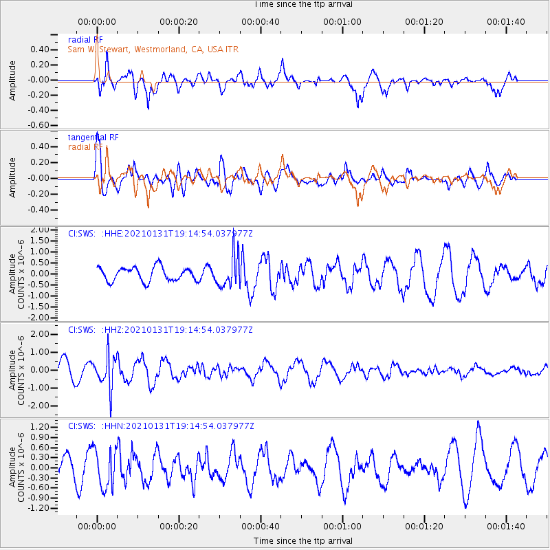
SWS Sam W. Stewart, Westmorland, CA, USA - Earthquake Result Viewer
*The percent match for this event was below the threshold and hence no stack was calculated.
| Earthquake location: |
Guyana |
| Earthquake latitude/longitude: |
2.6/-59.6 |
| Earthquake time(UTC): |
2021/01/31 (031) 19:05:15 GMT |
| Earthquake Depth: |
9.7 km |
| Earthquake Magnitude: |
5.7 Mww |
| Earthquake Catalog/Contributor: |
NEIC PDE/us |
|
| Network: |
CI Caltech Regional Seismic Network |
| Station: |
SWS Sam W. Stewart, Westmorland, CA, USA |
| Lat/Lon: |
32.94 N/115.80 W |
| Elevation: |
140 m |
|
| Distance: |
60.5 deg |
| Az: |
306.622 deg |
| Baz: |
107.553 deg |
| Ray Param: |
$rayparam |
*The percent match for this event was below the threshold and hence was not used in the summary stack. |
|
| Radial Match: |
76.20629 % |
| Radial Bump: |
394 |
| Transverse Match: |
68.46871 % |
| Transverse Bump: |
400 |
| SOD ConfigId: |
23341671 |
| Insert Time: |
2021-02-14 20:14:44.448 +0000 |
| GWidth: |
2.5 |
| Max Bumps: |
400 |
| Tol: |
0.001 |
|
Signal To Noise
| Channel | StoN | STA | LTA |
| CI:SWS: :HHZ:20210131T19:14:54.037977Z | 1.8842832 | 9.330554E-7 | 4.951779E-7 |
| CI:SWS: :HHN:20210131T19:14:54.037977Z | 1.4279454 | 5.702143E-7 | 3.9932502E-7 |
| CI:SWS: :HHE:20210131T19:14:54.037977Z | 2.3157063 | 7.2799133E-7 | 3.143712E-7 |
| Arrivals |
| Ps | |
| PpPs | |
| PsPs/PpSs | |


