You are here: Home > Network List > TA - USArray Transportable Network (new EarthScope stations) Stations List
> Station F24K Squaw Lake, AK, USA > Earthquake Result Viewer
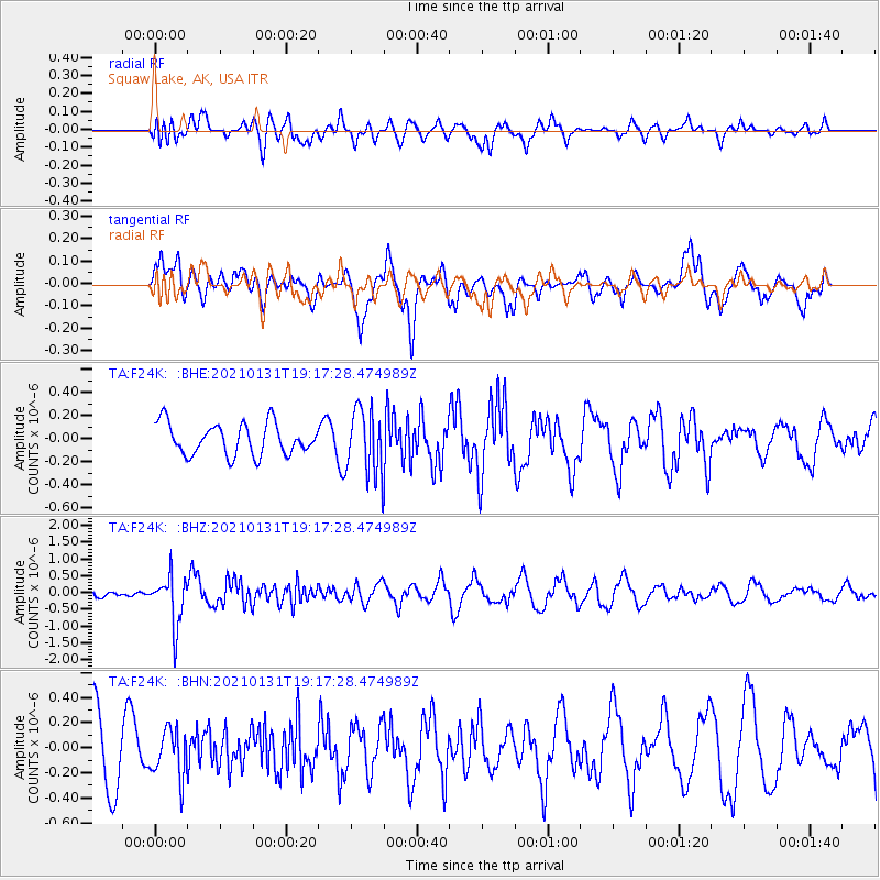
F24K Squaw Lake, AK, USA - Earthquake Result Viewer
*The percent match for this event was below the threshold and hence no stack was calculated.
| Earthquake location: |
Guyana |
| Earthquake latitude/longitude: |
2.6/-59.6 |
| Earthquake time(UTC): |
2021/01/31 (031) 19:05:15 GMT |
| Earthquake Depth: |
9.7 km |
| Earthquake Magnitude: |
5.7 Mww |
| Earthquake Catalog/Contributor: |
NEIC PDE/us |
|
| Network: |
TA USArray Transportable Network (new EarthScope stations) |
| Station: |
F24K Squaw Lake, AK, USA |
| Lat/Lon: |
67.52 N/147.89 W |
| Elevation: |
736 m |
|
| Distance: |
86.9 deg |
| Az: |
337.359 deg |
| Baz: |
90.597 deg |
| Ray Param: |
$rayparam |
*The percent match for this event was below the threshold and hence was not used in the summary stack. |
|
| Radial Match: |
33.817837 % |
| Radial Bump: |
400 |
| Transverse Match: |
61.441586 % |
| Transverse Bump: |
400 |
| SOD ConfigId: |
23341671 |
| Insert Time: |
2021-02-14 20:26:56.113 +0000 |
| GWidth: |
2.5 |
| Max Bumps: |
400 |
| Tol: |
0.001 |
|
Signal To Noise
| Channel | StoN | STA | LTA |
| TA:F24K: :BHZ:20210131T19:17:28.474989Z | 7.9557323 | 7.3526525E-7 | 9.2419555E-8 |
| TA:F24K: :BHN:20210131T19:17:28.474989Z | 0.7313909 | 1.8823981E-7 | 2.573724E-7 |
| TA:F24K: :BHE:20210131T19:17:28.474989Z | 2.0572145 | 2.7997632E-7 | 1.3609485E-7 |
| Arrivals |
| Ps | |
| PpPs | |
| PsPs/PpSs | |


