You are here: Home > Network List > TA - USArray Transportable Network (new EarthScope stations) Stations List
> Station R33M Jennings River, BC, CAN > Earthquake Result Viewer
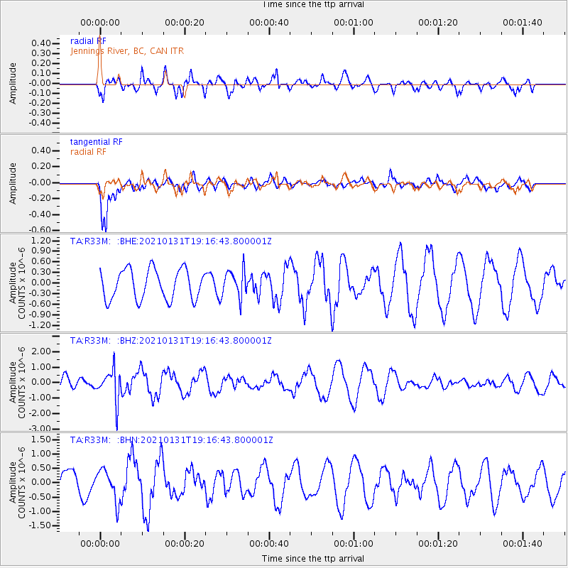
R33M Jennings River, BC, CAN - Earthquake Result Viewer
*The percent match for this event was below the threshold and hence no stack was calculated.
| Earthquake location: |
Guyana |
| Earthquake latitude/longitude: |
2.6/-59.6 |
| Earthquake time(UTC): |
2021/01/31 (031) 19:05:15 GMT |
| Earthquake Depth: |
9.7 km |
| Earthquake Magnitude: |
5.7 Mww |
| Earthquake Catalog/Contributor: |
NEIC PDE/us |
|
| Network: |
TA USArray Transportable Network (new EarthScope stations) |
| Station: |
R33M Jennings River, BC, CAN |
| Lat/Lon: |
59.39 N/130.97 W |
| Elevation: |
1437 m |
|
| Distance: |
78.3 deg |
| Az: |
330.326 deg |
| Baz: |
104.864 deg |
| Ray Param: |
$rayparam |
*The percent match for this event was below the threshold and hence was not used in the summary stack. |
|
| Radial Match: |
55.40178 % |
| Radial Bump: |
382 |
| Transverse Match: |
72.69797 % |
| Transverse Bump: |
400 |
| SOD ConfigId: |
23341671 |
| Insert Time: |
2021-02-14 20:27:42.557 +0000 |
| GWidth: |
2.5 |
| Max Bumps: |
400 |
| Tol: |
0.001 |
|
Signal To Noise
| Channel | StoN | STA | LTA |
| TA:R33M: :BHZ:20210131T19:16:43.800001Z | 2.6137273 | 1.0085987E-6 | 3.8588522E-7 |
| TA:R33M: :BHN:20210131T19:16:43.800001Z | 1.2744199 | 5.6535526E-7 | 4.4361778E-7 |
| TA:R33M: :BHE:20210131T19:16:43.800001Z | 0.8983881 | 3.8155557E-7 | 4.2471126E-7 |
| Arrivals |
| Ps | |
| PpPs | |
| PsPs/PpSs | |


