You are here: Home > Network List > US - United States National Seismic Network Stations List
> Station MIAR Mount Ida, Arkansas, USA > Earthquake Result Viewer
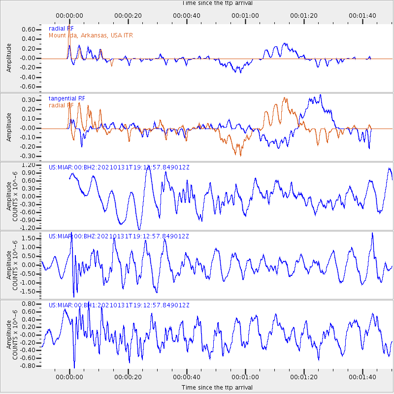
MIAR Mount Ida, Arkansas, USA - Earthquake Result Viewer
*The percent match for this event was below the threshold and hence no stack was calculated.
| Earthquake location: |
Guyana |
| Earthquake latitude/longitude: |
2.6/-59.6 |
| Earthquake time(UTC): |
2021/01/31 (031) 19:05:15 GMT |
| Earthquake Depth: |
9.7 km |
| Earthquake Magnitude: |
5.7 Mww |
| Earthquake Catalog/Contributor: |
NEIC PDE/us |
|
| Network: |
US United States National Seismic Network |
| Station: |
MIAR Mount Ida, Arkansas, USA |
| Lat/Lon: |
34.55 N/93.58 W |
| Elevation: |
207 m |
|
| Distance: |
44.8 deg |
| Az: |
319.119 deg |
| Baz: |
127.622 deg |
| Ray Param: |
$rayparam |
*The percent match for this event was below the threshold and hence was not used in the summary stack. |
|
| Radial Match: |
43.190582 % |
| Radial Bump: |
400 |
| Transverse Match: |
50.102448 % |
| Transverse Bump: |
400 |
| SOD ConfigId: |
23341671 |
| Insert Time: |
2021-02-14 20:30:04.493 +0000 |
| GWidth: |
2.5 |
| Max Bumps: |
400 |
| Tol: |
0.001 |
|
Signal To Noise
| Channel | StoN | STA | LTA |
| US:MIAR:00:BHZ:20210131T19:12:57.849012Z | 2.0504775 | 8.438065E-7 | 4.1151705E-7 |
| US:MIAR:00:BH1:20210131T19:12:57.849012Z | 2.55385 | 5.2073204E-7 | 2.039008E-7 |
| US:MIAR:00:BH2:20210131T19:12:57.849012Z | 0.92327386 | 5.4913704E-7 | 5.947715E-7 |
| Arrivals |
| Ps | |
| PpPs | |
| PsPs/PpSs | |


