You are here: Home > Network List > WY - Yellowstone Wyoming Seismic Network Stations List
> Station YHH Holmes Hill, YNP, WY, USA > Earthquake Result Viewer
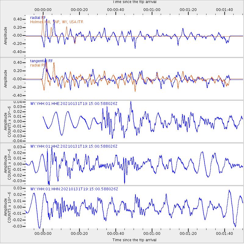
YHH Holmes Hill, YNP, WY, USA - Earthquake Result Viewer
*The percent match for this event was below the threshold and hence no stack was calculated.
| Earthquake location: |
Guyana |
| Earthquake latitude/longitude: |
2.6/-59.6 |
| Earthquake time(UTC): |
2021/01/31 (031) 19:05:15 GMT |
| Earthquake Depth: |
9.7 km |
| Earthquake Magnitude: |
5.7 Mww |
| Earthquake Catalog/Contributor: |
NEIC PDE/us |
|
| Network: |
WY Yellowstone Wyoming Seismic Network |
| Station: |
YHH Holmes Hill, YNP, WY, USA |
| Lat/Lon: |
44.79 N/110.85 W |
| Elevation: |
2717 m |
|
| Distance: |
61.5 deg |
| Az: |
320.812 deg |
| Baz: |
117.572 deg |
| Ray Param: |
$rayparam |
*The percent match for this event was below the threshold and hence was not used in the summary stack. |
|
| Radial Match: |
37.723797 % |
| Radial Bump: |
400 |
| Transverse Match: |
53.97778 % |
| Transverse Bump: |
363 |
| SOD ConfigId: |
23341671 |
| Insert Time: |
2021-02-14 20:32:02.815 +0000 |
| GWidth: |
2.5 |
| Max Bumps: |
400 |
| Tol: |
0.001 |
|
Signal To Noise
| Channel | StoN | STA | LTA |
| WY:YHH:01:HHZ:20210131T19:15:00.588026Z | 1.85274 | 1.943574E-8 | 1.0490268E-8 |
| WY:YHH:01:HHN:20210131T19:15:00.588026Z | 0.9700957 | 1.3792268E-8 | 1.4217431E-8 |
| WY:YHH:01:HHE:20210131T19:15:00.588026Z | 0.72478825 | 8.915327E-9 | 1.2300595E-8 |
| Arrivals |
| Ps | |
| PpPs | |
| PsPs/PpSs | |


