You are here: Home > Network List > CI - Caltech Regional Seismic Network Stations List
> Station DAN Danby, California, USA > Earthquake Result Viewer
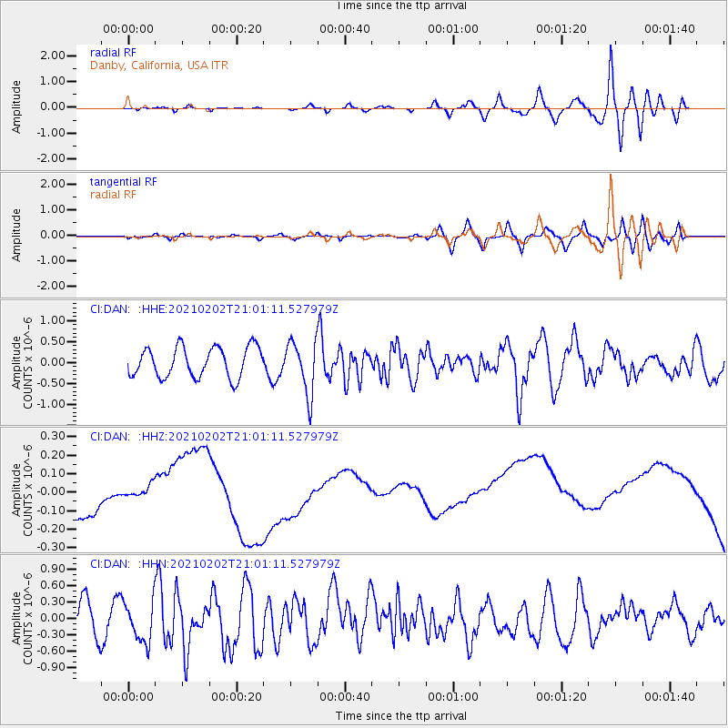
DAN Danby, California, USA - Earthquake Result Viewer
*The percent match for this event was below the threshold and hence no stack was calculated.
| Earthquake location: |
Fiji Islands |
| Earthquake latitude/longitude: |
-16.2/177.9 |
| Earthquake time(UTC): |
2021/02/02 (033) 20:49:28 GMT |
| Earthquake Depth: |
10 km |
| Earthquake Magnitude: |
5.8 Mww |
| Earthquake Catalog/Contributor: |
NEIC PDE/us |
|
| Network: |
CI Caltech Regional Seismic Network |
| Station: |
DAN Danby, California, USA |
| Lat/Lon: |
34.64 N/115.38 W |
| Elevation: |
398 m |
|
| Distance: |
81.0 deg |
| Az: |
50.055 deg |
| Baz: |
243.267 deg |
| Ray Param: |
$rayparam |
*The percent match for this event was below the threshold and hence was not used in the summary stack. |
|
| Radial Match: |
41.6856 % |
| Radial Bump: |
400 |
| Transverse Match: |
31.349373 % |
| Transverse Bump: |
400 |
| SOD ConfigId: |
23341671 |
| Insert Time: |
2021-02-16 21:58:48.069 +0000 |
| GWidth: |
2.5 |
| Max Bumps: |
400 |
| Tol: |
0.001 |
|
Signal To Noise
| Channel | StoN | STA | LTA |
| CI:DAN: :HHZ:20210202T21:01:11.527979Z | 0.6506488 | 6.233163E-8 | 9.57992E-8 |
| CI:DAN: :HHN:20210202T21:01:11.527979Z | 1.3436127 | 3.5759214E-7 | 2.661423E-7 |
| CI:DAN: :HHE:20210202T21:01:11.527979Z | 1.7926284 | 6.4197167E-7 | 3.5811755E-7 |
| Arrivals |
| Ps | |
| PpPs | |
| PsPs/PpSs | |


