You are here: Home > Network List > G - GEOSCOPE Stations List
> Station TAOE Taiohae, Marquises islands > Earthquake Result Viewer
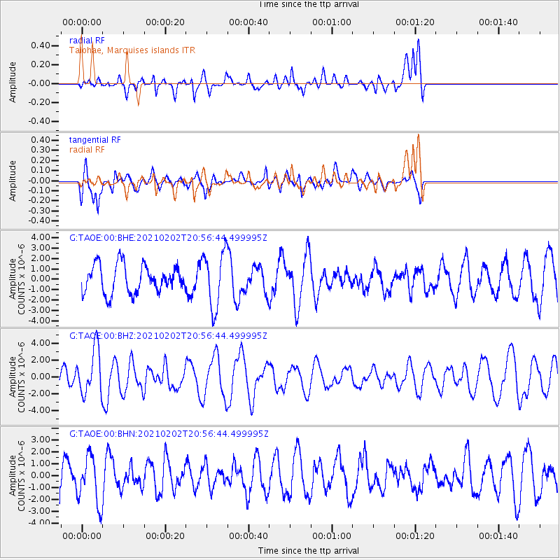
TAOE Taiohae, Marquises islands - Earthquake Result Viewer
*The percent match for this event was below the threshold and hence no stack was calculated.
| Earthquake location: |
Fiji Islands |
| Earthquake latitude/longitude: |
-16.2/177.9 |
| Earthquake time(UTC): |
2021/02/02 (033) 20:49:28 GMT |
| Earthquake Depth: |
10 km |
| Earthquake Magnitude: |
5.8 Mww |
| Earthquake Catalog/Contributor: |
NEIC PDE/us |
|
| Network: |
G GEOSCOPE |
| Station: |
TAOE Taiohae, Marquises islands |
| Lat/Lon: |
8.85 S/140.15 W |
| Elevation: |
800 m |
|
| Distance: |
41.5 deg |
| Az: |
85.017 deg |
| Baz: |
255.538 deg |
| Ray Param: |
$rayparam |
*The percent match for this event was below the threshold and hence was not used in the summary stack. |
|
| Radial Match: |
42.29173 % |
| Radial Bump: |
400 |
| Transverse Match: |
46.318336 % |
| Transverse Bump: |
400 |
| SOD ConfigId: |
23341671 |
| Insert Time: |
2021-02-16 22:01:02.014 +0000 |
| GWidth: |
2.5 |
| Max Bumps: |
400 |
| Tol: |
0.001 |
|
Signal To Noise
| Channel | StoN | STA | LTA |
| G:TAOE:00:BHZ:20210202T20:56:44.499995Z | 2.064058 | 2.7606093E-6 | 1.3374669E-6 |
| G:TAOE:00:BHN:20210202T20:56:44.499995Z | 1.2796385 | 2.0230493E-6 | 1.5809538E-6 |
| G:TAOE:00:BHE:20210202T20:56:44.499995Z | 2.0562878 | 2.754812E-6 | 1.3397016E-6 |
| Arrivals |
| Ps | |
| PpPs | |
| PsPs/PpSs | |


