You are here: Home > Network List > IW - Intermountain West Stations List
> Station PLID Pearl Lake, Idaho, USA > Earthquake Result Viewer
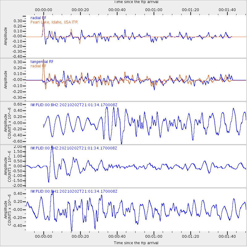
PLID Pearl Lake, Idaho, USA - Earthquake Result Viewer
*The percent match for this event was below the threshold and hence no stack was calculated.
| Earthquake location: |
Fiji Islands |
| Earthquake latitude/longitude: |
-16.2/177.9 |
| Earthquake time(UTC): |
2021/02/02 (033) 20:49:28 GMT |
| Earthquake Depth: |
10 km |
| Earthquake Magnitude: |
5.8 Mww |
| Earthquake Catalog/Contributor: |
NEIC PDE/us |
|
| Network: |
IW Intermountain West |
| Station: |
PLID Pearl Lake, Idaho, USA |
| Lat/Lon: |
45.09 N/116.00 W |
| Elevation: |
2164 m |
|
| Distance: |
85.4 deg |
| Az: |
40.511 deg |
| Baz: |
241.741 deg |
| Ray Param: |
$rayparam |
*The percent match for this event was below the threshold and hence was not used in the summary stack. |
|
| Radial Match: |
58.05857 % |
| Radial Bump: |
356 |
| Transverse Match: |
56.85213 % |
| Transverse Bump: |
400 |
| SOD ConfigId: |
23341671 |
| Insert Time: |
2021-02-16 22:02:27.854 +0000 |
| GWidth: |
2.5 |
| Max Bumps: |
400 |
| Tol: |
0.001 |
|
Signal To Noise
| Channel | StoN | STA | LTA |
| IW:PLID:00:BHZ:20210202T21:01:34.170008Z | 8.106762 | 9.583302E-7 | 1.18213684E-7 |
| IW:PLID:00:BH1:20210202T21:01:34.170008Z | 1.0950232 | 2.3366731E-7 | 2.133903E-7 |
| IW:PLID:00:BH2:20210202T21:01:34.170008Z | 1.4820207 | 2.941332E-7 | 1.9846767E-7 |
| Arrivals |
| Ps | |
| PpPs | |
| PsPs/PpSs | |


