You are here: Home > Network List > GM - US Geological Survey Networks Stations List
> Station IWM01 Jericho 2M Well Monitoring Station > Earthquake Result Viewer
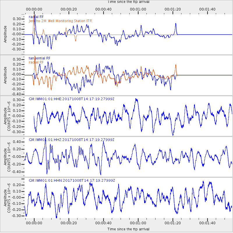
IWM01 Jericho 2M Well Monitoring Station - Earthquake Result Viewer
*The percent match for this event was below the threshold and hence no stack was calculated.
| Earthquake location: |
Tonga Islands |
| Earthquake latitude/longitude: |
-19.0/-175.6 |
| Earthquake time(UTC): |
2017/10/08 (281) 14:04:38 GMT |
| Earthquake Depth: |
10 km |
| Earthquake Magnitude: |
6.1 Mww |
| Earthquake Catalog/Contributor: |
NEIC PDE/us |
|
| Network: |
GM US Geological Survey Networks |
| Station: |
IWM01 Jericho 2M Well Monitoring Station |
| Lat/Lon: |
36.73 N/96.53 W |
| Elevation: |
328 m |
|
| Distance: |
92.8 deg |
| Az: |
52.151 deg |
| Baz: |
248.417 deg |
| Ray Param: |
$rayparam |
*The percent match for this event was below the threshold and hence was not used in the summary stack. |
|
| Radial Match: |
46.781612 % |
| Radial Bump: |
400 |
| Transverse Match: |
51.59443 % |
| Transverse Bump: |
400 |
| SOD ConfigId: |
2364251 |
| Insert Time: |
2017-10-22 14:09:05.202 +0000 |
| GWidth: |
2.5 |
| Max Bumps: |
400 |
| Tol: |
0.001 |
|
Signal To Noise
| Channel | StoN | STA | LTA |
| GM:IWM01:01:HHZ:20171008T14:17:19.27999Z | 1.2836827 | 1.4437293E-7 | 1.12467774E-7 |
| GM:IWM01:01:HHN:20171008T14:17:19.27999Z | 0.7363312 | 1.383472E-7 | 1.878872E-7 |
| GM:IWM01:01:HHE:20171008T14:17:19.27999Z | 0.86423904 | 1.02273674E-7 | 1.1833957E-7 |
| Arrivals |
| Ps | |
| PpPs | |
| PsPs/PpSs | |


