
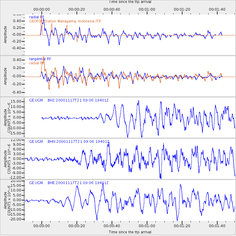
UGM GEOFON Station Wanagama, Indonesia - Earthquake Result Viewer
| ||||||||||||||||||
| ||||||||||||||||||
| ||||||||||||||||||
|
Signal To Noise
| Channel | StoN | STA | LTA |
| GE:UGM: :BHN:20001117T21:09:06.19401Z | 0.87364703 | 5.4682914E-7 | 6.259154E-7 |
| GE:UGM: :BHE:20001117T21:09:06.19401Z | 2.3086543 | 1.1363176E-6 | 4.9219915E-7 |
| GE:UGM: :BHZ:20001117T21:09:06.19401Z | 2.8847315 | 1.7704189E-6 | 6.137205E-7 |
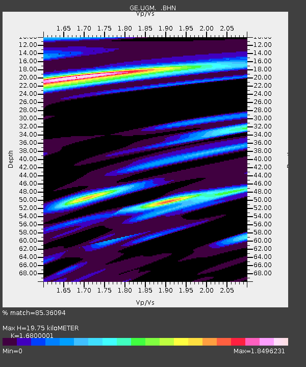
| Arrivals | |
| Ps | 2.3 SECOND |
| PpPs | 7.8 SECOND |
| PsPs/PpSs | 10 SECOND |

