
UGM GEOFON Station Wanagama, Indonesia - Earthquake Result Viewer
| ||||||||||||||||||
| ||||||||||||||||||
| ||||||||||||||||||
|
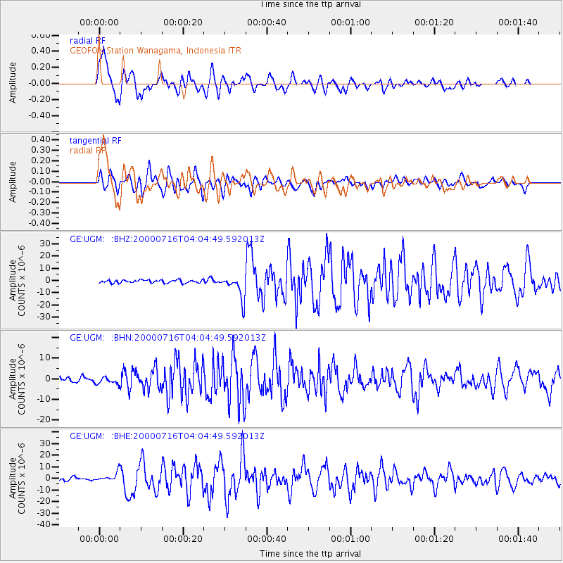
Signal To Noise
| Channel | StoN | STA | LTA |
| GE:UGM: :BHN:20000716T04:04:49.592013Z | 0.9744341 | 1.6545054E-6 | 1.6979142E-6 |
| GE:UGM: :BHE:20000716T04:04:49.592013Z | 2.4083583 | 3.985554E-6 | 1.6548842E-6 |
| GE:UGM: :BHZ:20000716T04:04:49.592013Z | 8.763453 | 1.0127643E-5 | 1.1556681E-6 |
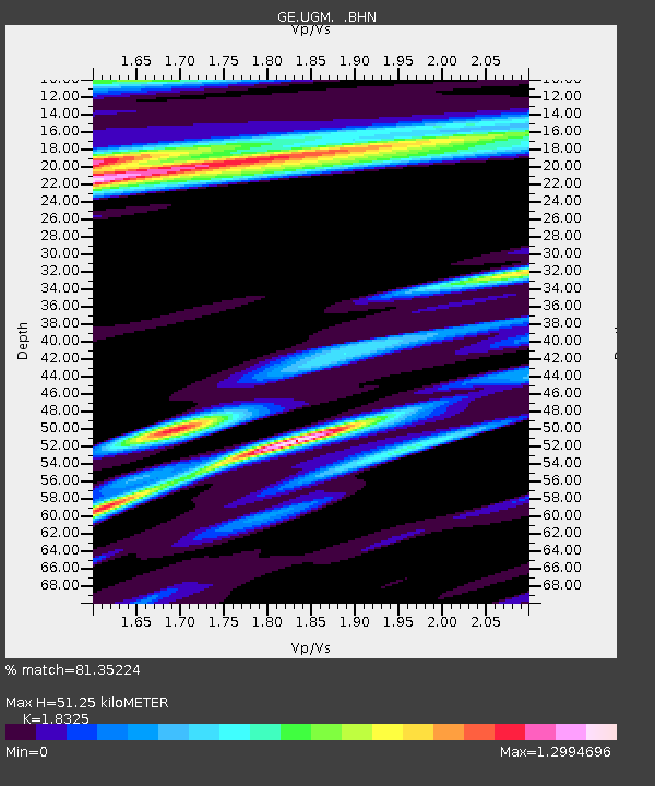
| Arrivals | |
| Ps | 7.2 SECOND |
| PpPs | 21 SECOND |
| PsPs/PpSs | 29 SECOND |

