You are here: Home > Network List > TA - USArray Transportable Network (new EarthScope stations) Stations List
> Station H31M Peel River, Yukon, CAN > Earthquake Result Viewer
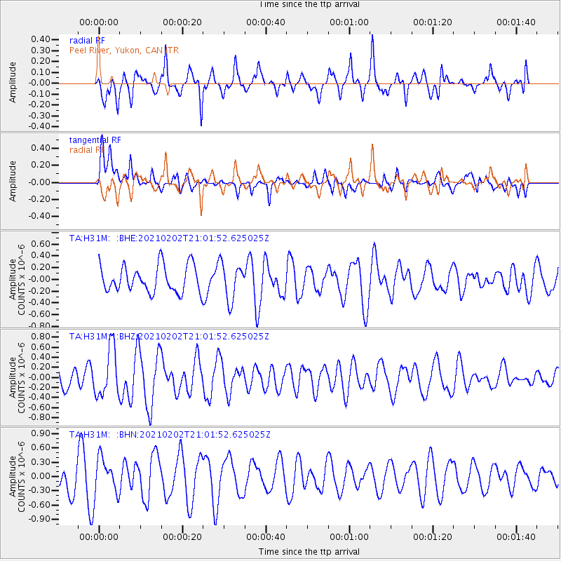
H31M Peel River, Yukon, CAN - Earthquake Result Viewer
*The percent match for this event was below the threshold and hence no stack was calculated.
| Earthquake location: |
Fiji Islands |
| Earthquake latitude/longitude: |
-16.2/177.9 |
| Earthquake time(UTC): |
2021/02/02 (033) 20:49:28 GMT |
| Earthquake Depth: |
10 km |
| Earthquake Magnitude: |
5.8 Mww |
| Earthquake Catalog/Contributor: |
NEIC PDE/us |
|
| Network: |
TA USArray Transportable Network (new EarthScope stations) |
| Station: |
H31M Peel River, Yukon, CAN |
| Lat/Lon: |
65.81 N/134.34 W |
| Elevation: |
642 m |
|
| Distance: |
89.3 deg |
| Az: |
17.759 deg |
| Baz: |
225.306 deg |
| Ray Param: |
$rayparam |
*The percent match for this event was below the threshold and hence was not used in the summary stack. |
|
| Radial Match: |
51.774208 % |
| Radial Bump: |
400 |
| Transverse Match: |
42.723083 % |
| Transverse Bump: |
400 |
| SOD ConfigId: |
23341671 |
| Insert Time: |
2021-02-16 22:06:52.417 +0000 |
| GWidth: |
2.5 |
| Max Bumps: |
400 |
| Tol: |
0.001 |
|
Signal To Noise
| Channel | StoN | STA | LTA |
| TA:H31M: :BHZ:20210202T21:01:52.625025Z | 2.0844269 | 4.936691E-7 | 2.3683684E-7 |
| TA:H31M: :BHN:20210202T21:01:52.625025Z | 0.98413545 | 3.5791467E-7 | 3.636844E-7 |
| TA:H31M: :BHE:20210202T21:01:52.625025Z | 1.3655231 | 3.1066548E-7 | 2.2750658E-7 |
| Arrivals |
| Ps | |
| PpPs | |
| PsPs/PpSs | |


