
UGM GEOFON Station Wanagama, Indonesia - Earthquake Result Viewer
| ||||||||||||||||||
| ||||||||||||||||||
| ||||||||||||||||||
|
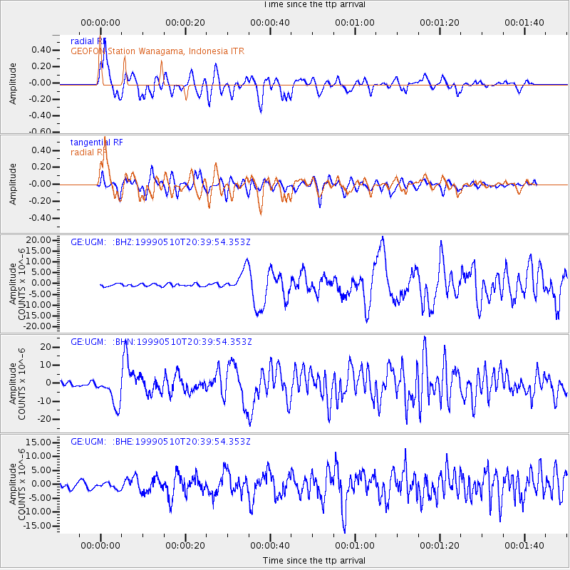
Signal To Noise
| Channel | StoN | STA | LTA |
| GE:UGM: :BHN:19990510T20:39:54.353Z | 9.005124 | 8.269278E-6 | 9.182859E-7 |
| GE:UGM: :BHE:19990510T20:39:54.353Z | 1.4112251 | 1.0707645E-6 | 7.587482E-7 |
| GE:UGM: :BHZ:19990510T20:39:54.353Z | 8.8455515 | 5.356945E-6 | 6.0560893E-7 |
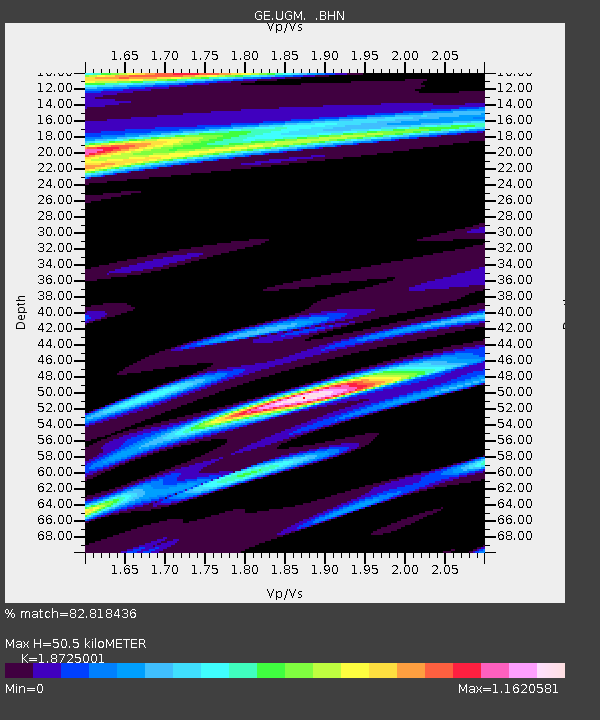
| Arrivals | |
| Ps | 7.4 SECOND |
| PpPs | 21 SECOND |
| PsPs/PpSs | 29 SECOND |

