You are here: Home > Network List > US - United States National Seismic Network Stations List
> Station EGMT Eagleton, Montana, USA > Earthquake Result Viewer
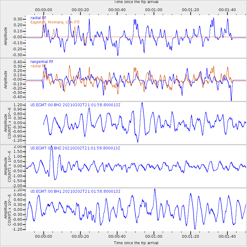
EGMT Eagleton, Montana, USA - Earthquake Result Viewer
*The percent match for this event was below the threshold and hence no stack was calculated.
| Earthquake location: |
Fiji Islands |
| Earthquake latitude/longitude: |
-16.2/177.9 |
| Earthquake time(UTC): |
2021/02/02 (033) 20:49:28 GMT |
| Earthquake Depth: |
10 km |
| Earthquake Magnitude: |
5.8 Mww |
| Earthquake Catalog/Contributor: |
NEIC PDE/us |
|
| Network: |
US United States National Seismic Network |
| Station: |
EGMT Eagleton, Montana, USA |
| Lat/Lon: |
48.02 N/109.75 W |
| Elevation: |
1055 m |
|
| Distance: |
90.6 deg |
| Az: |
39.764 deg |
| Baz: |
246.239 deg |
| Ray Param: |
$rayparam |
*The percent match for this event was below the threshold and hence was not used in the summary stack. |
|
| Radial Match: |
70.33797 % |
| Radial Bump: |
400 |
| Transverse Match: |
43.21484 % |
| Transverse Bump: |
400 |
| SOD ConfigId: |
23341671 |
| Insert Time: |
2021-02-16 22:09:30.004 +0000 |
| GWidth: |
2.5 |
| Max Bumps: |
400 |
| Tol: |
0.001 |
|
Signal To Noise
| Channel | StoN | STA | LTA |
| US:EGMT:00:BHZ:20210202T21:01:58.800013Z | 4.7987323 | 9.996662E-7 | 2.0831881E-7 |
| US:EGMT:00:BH1:20210202T21:01:58.800013Z | 1.0532836 | 3.2895454E-7 | 3.1231335E-7 |
| US:EGMT:00:BH2:20210202T21:01:58.800013Z | 1.0372931 | 4.3340162E-7 | 4.1781988E-7 |
| Arrivals |
| Ps | |
| PpPs | |
| PsPs/PpSs | |


