You are here: Home > Network List > US - United States National Seismic Network Stations List
> Station ELK Elko, Nevada, USA > Earthquake Result Viewer
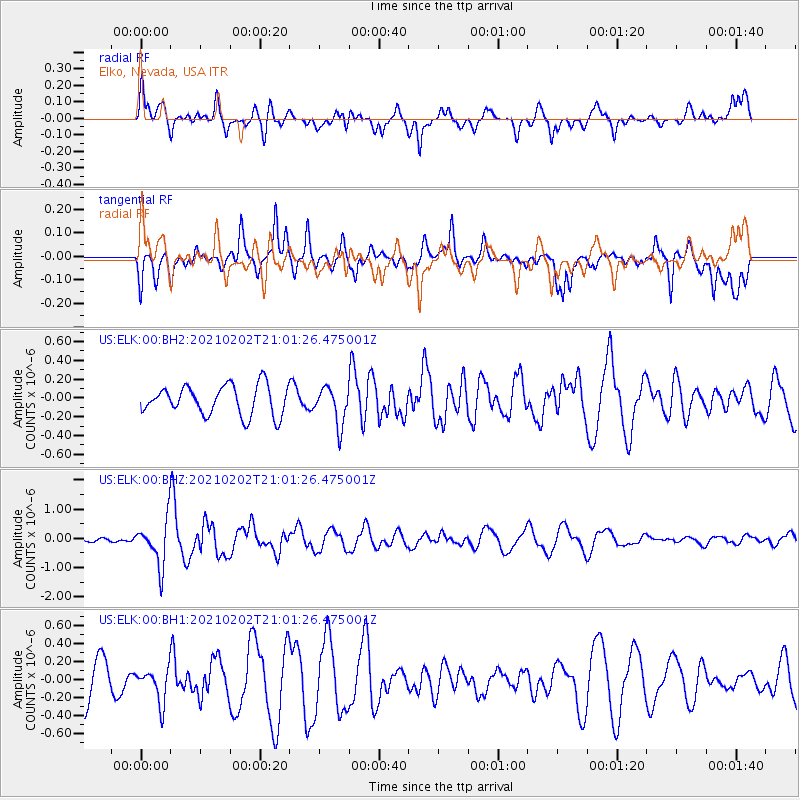
ELK Elko, Nevada, USA - Earthquake Result Viewer
*The percent match for this event was below the threshold and hence no stack was calculated.
| Earthquake location: |
Fiji Islands |
| Earthquake latitude/longitude: |
-16.2/177.9 |
| Earthquake time(UTC): |
2021/02/02 (033) 20:49:28 GMT |
| Earthquake Depth: |
10 km |
| Earthquake Magnitude: |
5.8 Mww |
| Earthquake Catalog/Contributor: |
NEIC PDE/us |
|
| Network: |
US United States National Seismic Network |
| Station: |
ELK Elko, Nevada, USA |
| Lat/Lon: |
40.74 N/115.24 W |
| Elevation: |
2210 m |
|
| Distance: |
83.9 deg |
| Az: |
44.629 deg |
| Baz: |
242.641 deg |
| Ray Param: |
$rayparam |
*The percent match for this event was below the threshold and hence was not used in the summary stack. |
|
| Radial Match: |
66.715996 % |
| Radial Bump: |
400 |
| Transverse Match: |
55.199436 % |
| Transverse Bump: |
400 |
| SOD ConfigId: |
23341671 |
| Insert Time: |
2021-02-16 22:09:31.608 +0000 |
| GWidth: |
2.5 |
| Max Bumps: |
400 |
| Tol: |
0.001 |
|
Signal To Noise
| Channel | StoN | STA | LTA |
| US:ELK:00:BHZ:20210202T21:01:26.475001Z | 4.3317165 | 7.722386E-7 | 1.7827543E-7 |
| US:ELK:00:BH1:20210202T21:01:26.475001Z | 0.7593346 | 1.8768178E-7 | 2.4716613E-7 |
| US:ELK:00:BH2:20210202T21:01:26.475001Z | 1.2654009 | 1.9778972E-7 | 1.5630597E-7 |
| Arrivals |
| Ps | |
| PpPs | |
| PsPs/PpSs | |


